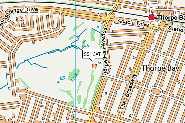
Thorpe Hall Golf Club - Southend-on-sea
Thorpe Hall Golf Club is located in Southend-on-sea (SS1), and offers Golf.
| Address | Thorpe Hall Avenue, Southend-on-sea, SS1 3AT |
| Car Park | Yes |
| Car Park Capacity | 90 |
| Management Type | Sport Club |
| Management Group | Others |
| Owner Type | Sports Club |
| Owner Group | Sports Club |
| Education Phase | Not applicable |
Facilities
| Accessibility | Registered Membership use |
| Management Type | Sport Club |
| Year Built | 1907 |
| Changing Rooms | Yes |
| Year Changing Rooms Refurbished | 2001 |
| Date Record Checked | 2nd Jun 2023 |
| Opening Times | Dawn To Dusk |
Facility specifics
Disabled access
| Disabled Access | Yes |
| Disabled Parking | Yes |
| Finding/Reaching Entrance | Yes |
| Reception Area | Yes |
| Doorways | Yes |
| Activity Areas | Yes |
| Disabled Toilets | Yes |
| Social Areas | Yes |
| Emergency Exits | Yes |
| Status Notes | Not used for squash anymore - used for teaching. |
| Accessibility | Sports Club / Community Association |
| Management Type | Sport Club |
| Year Built | 1975 |
| Changing Rooms | Yes |
| Year Changing Rooms Refurbished | 2001 |
| Date Record Checked | 2nd Jun 2023 |
Opening times
| Access description | Sports Club / Community Association |
|---|
| Opening time | 08:00 |
| Closing time | 21:00 |
| Period open for | Every day |
Facility specifics
Disabled access
| Disabled Access | Yes |
| Disabled Parking | Yes |
| Finding/Reaching Entrance | Yes |
| Reception Area | Yes |
| Doorways | Yes |
| Activity Areas | Yes |
| Disabled Toilets | Yes |
| Social Areas | Yes |
| Emergency Exits | Yes |
Contact
Disabled access
Disabled access for Thorpe Hall Golf Club
| Disabled Access | Yes |
| Disabled Parking | Yes |
| Finding/Reaching Entrance | Yes |
| Reception Area | Yes |
| Doorways | Yes |
| Activity Areas | Yes |
| Disabled Toilets | Yes |
| Social Areas | Yes |
| Emergency Exits | Yes |
| Notes | Lift |
Where is Thorpe Hall Golf Club?
| Sub Building Name | |
| Building Name | |
| Building Number | 0 |
| Dependent Thoroughfare | |
| Thoroughfare Name | THORPE HALL AVENUE |
| Double Dependent Locality | |
| Dependent Locality | |
| PostTown | SOUTHEND-ON-SEA |
| Postcode | SS1 3AT |
Thorpe Hall Golf Club on a map

Thorpe Hall Golf Club geodata
| Easting | 591148 |
| Northing | 185320 |
| Latitude | 51.534417 |
| Longitude | 0.75463 |
| Local Authority Name | Southend-on-Sea |
| Local Authority Code | E06000033 |
| Parliamentary Constituency Name | Rochford and Southend East |
| Parliamentary Constituency Code | E14000899 |
| Region Name | Eastern |
| Region Code | E15000006 |
| Ward Name | Thorpe |
| Ward Code | E05002224 |
| Output Area Code | E00080359 |
About this data
This data is open data sourced from Active Places Power and licenced under the Active Places Open Data Licence.
| toid | osgb1000001792800 |
| Created On | 26th Apr 2004 |
| Audited On | 2nd Jun 2023 |
| Checked On | 2nd Jun 2023 |
