Thornton Cleveleys Football Club
Thornton Cleveleys Football Club is located in Thornton Cleveleys (FY5), and offers Grass Pitches.
| Address | THORNTON CLEVELEYS FOOTBALL CLUB, Gamble Road, Thornton Cleveleys, FY5 4JH |
| Management Type | Sport Club |
| Management Group | Others |
| Owner Type | Sports Club |
| Owner Group | Sports Club |
| Education Phase | Not applicable |
Aliases
Thornton Cleveleys Football Club is also known as:
- Gamble Road Recreation Ground
Facilities
| Accessibility | Sports Club / Community Association |
| Management Type | Sport Club |
| Year Built | 2020 |
| Changing Rooms | Yes |
| Date Record Checked | 16th Nov 2022 |
| Opening Times | Dawn To Dusk |
Facility specifics
| Accessibility | Sports Club / Community Association |
| Management Type | Sport Club |
| Year Built | 2020 |
| Changing Rooms | Yes |
| Date Record Created | 28th Aug 2018 |
| Date Record Checked | 16th Nov 2022 |
| Opening Times | Dawn To Dusk |
Facility specifics
| Accessibility | Private Use |
| Management Type | Sport Club |
| Year Built | 2020 |
| Changing Rooms | Yes |
| Date Record Created | 22nd Jun 2022 |
| Date Record Checked | 16th Nov 2022 |
| Opening Times | Dawn To Dusk |
Facility specifics
| Accessibility | Private Use |
| Management Type | Sport Club |
| Year Built | 2020 |
| Changing Rooms | Yes |
| Date Record Created | 22nd Jun 2022 |
| Date Record Checked | 16th Nov 2022 |
| Opening Times | Dawn To Dusk |
Facility specifics
| Accessibility | Private Use |
| Management Type | Sport Club |
| Year Built | 2020 |
| Changing Rooms | Yes |
| Date Record Created | 22nd Jun 2022 |
| Date Record Checked | 16th Nov 2022 |
| Opening Times | Dawn To Dusk |
Facility specifics
Contact
Where is Thornton Cleveleys Football Club?
| Sub Building Name | |
| Building Name | THORNTON CLEVELEYS FOOTBALL CLUB |
| Building Number | 0 |
| Dependent Thoroughfare | |
| Thoroughfare Name | GAMBLE ROAD |
| Double Dependent Locality | |
| Dependent Locality | |
| PostTown | THORNTON CLEVELEYS |
| Postcode | FY5 4JH |
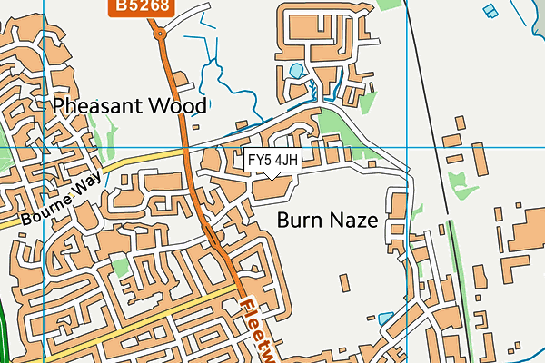
Thornton Cleveleys Football Club on a map

Thornton Cleveleys Football Club geodata
| Easting | 333815.2 |
| Northing | 443866.03 |
| Latitude | 53.886737 |
| Longitude | -3.008431 |
| Local Authority Name | Wyre |
| Local Authority Code | E07000128 |
| Parliamentary Constituency Name | Blackpool North and Cleveleys |
| Parliamentary Constituency Code | E14000572 |
| Region Name | North West |
| Region Code | E15000002 |
| Ward Name | Bourne |
| Ward Code | E05009932 |
| Output Area Code | E00129614 |
About this data
This data is open data sourced from Active Places Power and licenced under the Active Places Open Data Licence.
| toid | osgb1000000230012058 |
| Created On | 6th Dec 2009 |
| Audited On | 16th Nov 2022 |
| Checked On | 16th Nov 2022 |
