The Tumps - Patchway
The Tumps is located in Patchway, Bristol (BS34), and offers Cycling.
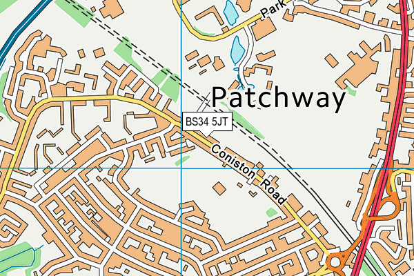
| Address | Coniston Road, Patchway, Bristol, BS34 5JT |
| Management Type | Sport Club |
| Management Group | Others |
| Owner Type | Local Authority |
| Owner Group | Local Authority |
| Education Phase | Not applicable |
Facilities
| Accessibility | Sports Club / Community Association |
| Management Type | Sport Club |
| Year Built | 1999 |
| Year Refurbished | 2012 |
| Changing Rooms | No |
| Date Record Created | 24th Feb 2017 |
| Date Record Checked | 12th May 2023 |
| Opening Times | Dawn To Dusk |
Facility specifics
| Automatic Start Gate | No |
| Finish Straight Length | 39m |
| Finish Straight Width | 6m |
| Floodlit | No |
| Overall Width | 6m |
| Start Gate | Yes |
| Start Hill Elevation | 5m |
| Start Hill Width | 8m |
| Start Straight Length | 47m |
| Start Straight Width | 6.5m |
| Surface | Concrete |
| Total Length | 300m |
Contact
Where is The Tumps?
| Sub Building Name | |
| Building Name | |
| Building Number | 0 |
| Dependent Thoroughfare | |
| Thoroughfare Name | CONISTON ROAD |
| Double Dependent Locality | |
| Dependent Locality | PATCHWAY |
| PostTown | BRISTOL |
| Postcode | BS34 5JT |
The Tumps on a map

The Tumps geodata
| Easting | 360067.89 |
| Northing | 182179.07 |
| Latitude | 51.537092 |
| Longitude | -2.577131 |
| Local Authority Name | South Gloucestershire |
| Local Authority Code | E06000025 |
| Parliamentary Constituency Name | Filton and Bradley Stoke |
| Parliamentary Constituency Code | E14000702 |
| Region Name | South West |
| Region Code | E15000009 |
| Ward Name | Patchway Coniston |
| Ward Code | E05012121 |
| Output Area Code | E00075517 |
About this data
This data is open data sourced from Active Places Power and licenced under the Active Places Open Data Licence.
| toid | osgb1000015069027 |
| Created On | 24th Feb 2017 |
| Audited On | 12th May 2023 |
| Checked On | 12th May 2023 |
