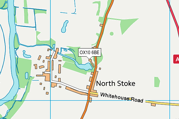
The Springs Golf Club - North Stoke
The Springs Golf Club is located in North Stoke, Wallingford (OX10), and offers Golf.
| Address | 1, Wallingford Road, North Stoke, Wallingford, OX10 6BE |
| Car Park | Yes |
| Car Park Capacity | 200 |
| Management Type | Commercial Management |
| Management Group | Commercial |
| Owner Type | Commercial |
| Owner Group | Commercial |
| Education Phase | Not applicable |
Facilities
| Accessibility | Pay and Play |
| Management Type | Commercial Management |
| Year Built | 1996 |
| Changing Rooms | Yes |
| Year Changing Rooms Refurbished | 2009 |
| Date Record Checked | 27th Jun 2023 |
| Opening Times | Dawn To Dusk |
Facility specifics
Disabled access
| Disabled Access | Yes |
| Disabled Parking | Yes |
| Finding/Reaching Entrance | Yes |
| Reception Area | Yes |
| Doorways | Yes |
| Activity Areas | Yes |
| Disabled Toilets | Yes |
| Social Areas | Yes |
| Spectator Areas | Yes |
| Emergency Exits | Yes |
| Closure Date | 22nd Oct 2014 |
| Closure Reason | Unclassified |
| Accessibility | Private Use |
| Management Type | Not Known |
| Year Built | 1996 |
| Changing Rooms | Yes |
| Date Record Checked | 27th Jun 2023 |
| Opening Times | Detailed Timings |
Facility specifics
| Access to Pool Hoist | No |
| Area | 70m² |
| Diving Boards | No |
| Length | 10m |
| Maximum Depth | 0m |
| Minimum Depth | 0m |
| Movable Floor | No |
| Width | 7m |
Disabled access
| Disabled Access | Yes |
| Disabled Parking | Yes |
| Finding/Reaching Entrance | Yes |
| Reception Area | Yes |
| Doorways | Yes |
| Activity Areas | Yes |
| Disabled Toilets | Yes |
| Social Areas | Yes |
| Spectator Areas | Yes |
| Emergency Exits | Yes |
| Notes | buggy hire |
Contact
Disabled access
Disabled access for The Springs Golf Club
| Disabled Access | Yes |
| Disabled Parking | Yes |
| Finding/Reaching Entrance | Yes |
| Reception Area | Yes |
| Doorways | Yes |
| Activity Areas | Yes |
| Disabled Toilets | Yes |
| Social Areas | Yes |
| Spectator Areas | Yes |
| Emergency Exits | Yes |
| Notes | buggy hire |
Where is The Springs Golf Club?
| Sub Building Name | |
| Building Name | |
| Building Number | 1 |
| Dependent Thoroughfare | |
| Thoroughfare Name | WALLINGFORD ROAD |
| Double Dependent Locality | |
| Dependent Locality | NORTH STOKE |
| PostTown | WALLINGFORD |
| Postcode | OX10 6BE |
The Springs Golf Club on a map

The Springs Golf Club geodata
| Easting | 461329.58 |
| Northing | 186342.33 |
| Latitude | 51.572623 |
| Longitude | -1.116456 |
| Local Authority Name | South Oxfordshire |
| Local Authority Code | E07000179 |
| Parliamentary Constituency Name | Henley |
| Parliamentary Constituency Code | E14000742 |
| Region Name | South East |
| Region Code | E15000008 |
| Ward Name | Benson & Crowmarsh |
| Ward Code | E05009733 |
| Output Area Code | E00145785 |
About this data
This data is open data sourced from Active Places Power and licenced under the Active Places Open Data Licence.
| toid | osgb1000013825234 |
| Created On | 26th Apr 2004 |
| Audited On | 27th Jun 2023 |
| Checked On | 27th Jun 2023 |
