The Recreation Ground (Closed) - Langley Park
The Recreation Ground (Closed) is located in Langley Park, Durham (DH7).
| Address | Bridge Street, Langley Park, Durham, DH7 9SQ |
| Management Type | Community Organisation |
| Management Group | Others |
| Owner Type | Community Organisation |
| Owner Group | Community Organisation |
| Education Phase | Not Known |
| Closure Date | 1st Jan 2004 |
| Closure Reason | Unclassified |
Facilities
| Closure Date | 1st Jan 2004 |
| Closure Reason | Unclassified |
| Accessibility | Pay and Play |
| Management Type | Not Known |
| Changing Rooms | No |
| Date Record Checked | 24th Apr 2009 |
| Opening Times | Detailed Timings |
Facility specifics
Where is The Recreation Ground (Closed)?
| Sub Building Name | |
| Building Name | |
| Building Number | 0 |
| Dependent Thoroughfare | |
| Thoroughfare Name | Bridge Street |
| Double Dependent Locality | |
| Dependent Locality | Langley Park |
| PostTown | Durham |
| Postcode | DH7 9SQ |
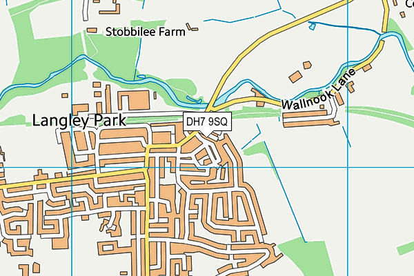
The Recreation Ground (Closed) on a map

The Recreation Ground (Closed) geodata
| Easting | 421775 |
| Northing | 544766 |
| Latitude | 54.797308 |
| Longitude | -1.662837 |
| Local Authority Name | County Durham |
| Local Authority Code | E06000047 |
| Parliamentary Constituency Name | City of Durham |
| Parliamentary Constituency Code | E14000641 |
| Region Name | North East |
| Region Code | E15000001 |
| Ward Name | Esh and Witton Gilbert |
| Ward Code | E05009061 |
| Output Area Code | E00104937 |
About this data
This data is open data sourced from Active Places Power and licenced under the Active Places Open Data Licence.
| Created On | 18th May 2007 |
| Audited On | 26th Jan 2015 |
| Checked On | 24th Apr 2009 |
