The Health Club Within City Limits (Closed) - Romford
The Health Club Within City Limits (Closed) is located in Romford (RM5).
| Address | Collier Row Road, Romford, RM5 2BH |
| Car Park | Yes |
| Car Park Capacity | 150 |
| Management Type | Not Known |
| Management Group | Not Known |
| Owner Type | Commercial |
| Owner Group | Commercial |
| Education Phase | Not Known |
| Closure Date | 31st Mar 2006 |
| Closure Reason | Unclassified |
Facilities
| Closure Date | 31st Mar 2006 |
| Closure Reason | Unclassified |
| Accessibility | Registered Membership use |
| Management Type | Not Known |
| Year Built | 1990 |
| Year Refurbished | 1999 |
| Changing Rooms | Yes |
| Date Record Checked | 12th Apr 2006 |
| Opening Times | Detailed Timings |
Facility specifics
| Area | 139.35m² |
| Floor Matting | Don't Know |
| Gymnastics Trampoline Use | Don't Know |
| Length | 0m |
| Moveable Balance Apparatus | Don't Know |
| Moveable Large Apparatus | Don't Know |
| Moveable Rebound Apparatus | Don't Know |
| Moveable Trampolines | Don't Know |
| Small Apparatus | Don't Know |
| Swinging and Hanging Apparatus | Don't Know |
| Width | 0m |
| Closure Date | 31st Mar 2006 |
| Closure Reason | Unclassified |
| Accessibility | Registered Membership use |
| Management Type | Not Known |
| Year Built | 1990 |
| Year Refurbished | 1999 |
| Changing Rooms | Yes |
| Date Record Checked | 12th Apr 2006 |
| Opening Times | Detailed Timings |
Facility specifics
Disabled access
Disabled access for The Health Club Within City Limits (Closed)
| Disabled Access | Yes |
| Disabled Parking | Yes |
| Finding/Reaching Entrance | Yes |
| Reception Area | Yes |
| Doorways | Yes |
| Disabled Changing Facilities | Yes |
| Activity Areas | Yes |
| Disabled Toilets | Yes |
| Social Areas | Yes |
| Emergency Exits | Yes |
| Notes | Changing Facilities: The female changing facilities are up some stairs |
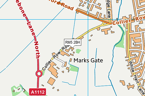
Where is The Health Club Within City Limits (Closed)?
| Sub Building Name | |
| Building Name | |
| Building Number | 0 |
| Dependent Thoroughfare | |
| Thoroughfare Name | Collier Row Road |
| Double Dependent Locality | |
| Dependent Locality | |
| PostTown | Romford |
| Postcode | RM5 2BH |
The Health Club Within City Limits (Closed) on a map

The Health Club Within City Limits (Closed) geodata
| Easting | 548810 |
| Northing | 190748 |
| Latitude | 51.595927 |
| Longitude | 0.147011 |
| Local Authority Name | Barking and Dagenham |
| Local Authority Code | E09000002 |
| Parliamentary Constituency Name | Dagenham and Rainham |
| Parliamentary Constituency Code | E14000657 |
| Region Name | London |
| Region Code | E15000007 |
| Ward Name | Chadwell Heath |
| Ward Code | E05014058 |
| Output Area Code | E00000156 |
About this data
This data is open data sourced from Active Places Power and licenced under the Active Places Open Data Licence.
| Created On | 14th Dec 2014 |
| Audited On | 26th Jan 2015 |
| Checked On | 12th Apr 2006 |
