The Green Hut (Closed) - Crowthorne
The Green Hut (Closed) is located in Crowthorne (RG45).
| Address | Napier Road, Crowthorne, RG45 7EJ |
| Management Type | Health Authority |
| Management Group | Others |
| Owner Type | Health Authority |
| Owner Group | Others |
| Education Phase | Not Known |
| Closure Date | 28th Feb 2014 |
| Closure Reason | Redevelopment - loss due to development project (e.g. major schemes such as HS2, new roads, area regeneration or smaller local development) |
Facilities
| Closure Date | 28th Feb 2014 |
| Closure Reason | Redevelopment - loss due to development project (e.g. major schemes such as HS2, new roads, area regeneration or smaller local development) |
| Accessibility | Sports Club / Community Association |
| Management Type | Health Authority |
| Changing Rooms | No |
| Date Record Checked | 27th Apr 2018 |
Opening times
| Access description | Sports Club / Community Association |
|---|
| Opening time | 09:00 |
| Closing time | 22:00 |
| Period open for | Every day |
Facility specifics
| Area | 0m² |
| Floor Matting | Don't Know |
| Gymnastics Trampoline Use | Don't Know |
| Length | 0m |
| Moveable Balance Apparatus | Don't Know |
| Moveable Large Apparatus | Don't Know |
| Moveable Rebound Apparatus | Don't Know |
| Moveable Trampolines | Don't Know |
| Width | 0m |
| Small Apparatus | Don't Know |
| Swinging and Hanging Apparatus | Don't Know |
Where is The Green Hut (Closed)?
| Sub Building Name | |
| Building Name | |
| Building Number | 0 |
| Dependent Thoroughfare | |
| Thoroughfare Name | Napier Road |
| Double Dependent Locality | |
| Dependent Locality | |
| PostTown | Crowthorne |
| Postcode | RG45 7EJ |
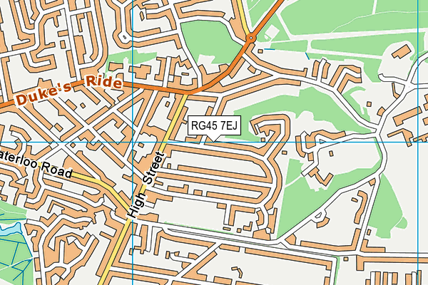
The Green Hut (Closed) on a map

The Green Hut (Closed) geodata
| Easting | 485442.16 |
| Northing | 164238.8 |
| Latitude | 51.370791 |
| Longitude | -0.773942 |
| Local Authority Name | Bracknell Forest |
| Local Authority Code | E06000036 |
| Parliamentary Constituency Name | Bracknell |
| Parliamentary Constituency Code | E14000586 |
| Region Name | South East |
| Region Code | E15000008 |
| Ward Name | Crowthorne |
| Ward Code | E05002277 |
| Output Area Code | E00081899 |
About this data
This data is open data sourced from Active Places Power and licenced under the Active Places Open Data Licence.
| Created On | 10th Feb 2014 |
| Audited On | 7th Jul 2011 |
| Checked On | 7th Jul 2011 |
