The Granville School - Sevenoaks
The Granville School is located in Sevenoaks (TN13), and offers Swimming Pool.
| Address | 2, Bradbourne Park Road, Sevenoaks, TN13 3LJ |
| Car Park | Yes |
| Car Park Capacity | 25 |
| Management Type | School/College/University (in house) |
| Management Group | Education |
| Owner Type | Other Independent School |
| Owner Group | Education |
| Education Phase | Primary |
Facilities
| Status Notes | The Jubilee Hall houses the indoor swimming pool. Flexible flooring enables the pool to be covered and the hall used for indoor sports. Swimming Pool converts into Sports Hall around Mid-Autumn and revert back towards the Summer. |
| Accessibility | Private Use |
| Management Type | School/College/University (in house) |
| Year Built | 1957 |
| Year Refurbished | 2017 |
| Changing Rooms | Yes |
| Date Record Created | 6th Sep 2018 |
| Date Record Checked | 11th Oct 2022 |
Opening times
| Access description | Private Use |
|---|
| Opening time | 08:30 |
| Closing time | 16:00 |
| Period open for | Monday-Friday |
Facility specifics
| Access to Pool Hoist | No |
| Area | 140m² |
| Diving Boards | No |
| Length | 20m |
| Maximum Depth | 1m |
| Minimum Depth | 1m |
| Movable Floor | No |
| Width | 7m |
Disabled access
| Disabled Access | Yes |
| Disabled Parking | Yes |
| Finding/Reaching Entrance | Yes |
| Reception Area | Yes |
| Doorways | Yes |
| Disabled Changing Facilities | Yes |
| Activity Areas | Yes |
| Disabled Toilets | Yes |
| Social Areas | Yes |
| Spectator Areas | Yes |
| Emergency Exits | Yes |
Contact
Disabled access
Disabled access for The Granville School
| Disabled Access | Yes |
| Disabled Parking | Yes |
| Finding/Reaching Entrance | Yes |
| Reception Area | Yes |
| Doorways | Yes |
| Disabled Changing Facilities | Yes |
| Activity Areas | Yes |
| Disabled Toilets | Yes |
| Social Areas | Yes |
| Spectator Areas | Yes |
| Emergency Exits | Yes |
Where is The Granville School?
| Sub Building Name | |
| Building Name | |
| Building Number | 2 |
| Dependent Thoroughfare | |
| Thoroughfare Name | BRADBOURNE PARK ROAD |
| Double Dependent Locality | |
| Dependent Locality | |
| PostTown | SEVENOAKS |
| Postcode | TN13 3LJ |
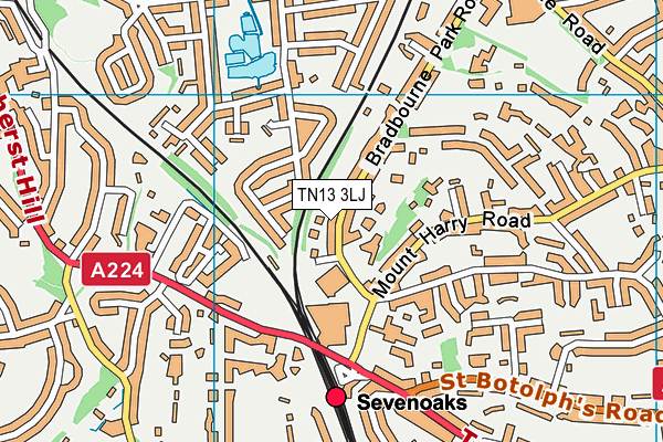
The Granville School on a map

The Granville School geodata
| Easting | 552343 |
| Northing | 155658 |
| Latitude | 51.279701 |
| Longitude | 0.182893 |
| Local Authority Name | Sevenoaks |
| Local Authority Code | E07000111 |
| Parliamentary Constituency Name | Sevenoaks |
| Parliamentary Constituency Code | E14000918 |
| Region Name | South East |
| Region Code | E15000008 |
| Ward Name | Sevenoaks Town and St. John's |
| Ward Code | E05005029 |
| Output Area Code | E00124201 |
About this data
This data is open data sourced from Active Places Power and licenced under the Active Places Open Data Licence.
| toid | osgb1000000313060 |
| Created On | 6th Sep 2018 |
| Audited On | 11th Oct 2022 |
| Checked On | 11th Oct 2022 |
