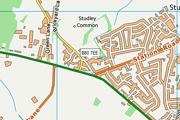
The Golf Centre (Closed) - Studley
The Golf Centre (Closed) is located in Studley (B80).
| Address | Brickyard Lane, Studley, B80 7EE |
| Car Park | Yes |
| Car Park Capacity | 50 |
| Management Type | Commercial Management |
| Management Group | Commercial |
| Owner Type | Commercial |
| Owner Group | Commercial |
| Education Phase | Not Known |
| Closure Date | 12th Apr 2017 |
| Closure Reason | Strategic Review - facility/site not being replaced |
Facilities
| Closure Date | 12th Apr 2017 |
| Closure Reason | Strategic Review - facility/site not being replaced |
| Accessibility | Pay and Play |
| Management Type | Commercial Management |
| Year Built | 1986 |
| Changing Rooms | No |
| Date Record Checked | 12th Apr 2017 |
Opening times
| Access description | Pay and Play |
|---|
| Opening time | 11:00 |
| Closing time | 18:00 |
| Period open for | Weekend |
| |
| Access description | Pay and Play |
|---|
| Opening time | 11:00 |
| Closing time | 19:00 |
| Period open for | Monday-Friday |
Facility specifics
Disabled access
| Disabled Access | Yes |
| Disabled Parking | Yes |
| Finding/Reaching Entrance | Yes |
| Doorways | Yes |
| Activity Areas | Yes |
| Spectator Areas | Yes |
| Emergency Exits | Yes |
Contact
Disabled access
Disabled access for The Golf Centre (Closed)
| Disabled Access | Yes |
| Disabled Parking | Yes |
| Finding/Reaching Entrance | Yes |
| Doorways | Yes |
| Activity Areas | Yes |
| Spectator Areas | Yes |
| Emergency Exits | Yes |
Where is The Golf Centre (Closed)?
| Sub Building Name | |
| Building Name | |
| Building Number | 0 |
| Dependent Thoroughfare | |
| Thoroughfare Name | Brickyard Lane |
| Double Dependent Locality | |
| Dependent Locality | |
| PostTown | Studley |
| Postcode | B80 7EE |
The Golf Centre (Closed) on a map

The Golf Centre (Closed) geodata
| Easting | 406147.7 |
| Northing | 263870.7 |
| Latitude | 52.272956 |
| Longitude | -1.911324 |
| Local Authority Name | Stratford-on-Avon |
| Local Authority Code | E07000221 |
| Parliamentary Constituency Name | Stratford-on-Avon |
| Parliamentary Constituency Code | E14000977 |
| Region Name | West Midlands |
| Region Code | E15000005 |
| Ward Name | Studley with Mappleborough Green |
| Ward Code | E05010205 |
| Output Area Code | E00159277 |
About this data
This data is open data sourced from Active Places Power and licenced under the Active Places Open Data Licence.
| Created On | 26th Apr 2004 |
| Audited On | 11th May 2016 |
| Checked On | 12th Apr 2017 |
