Swancote Health & Fitness Centre (Closed)
Swancote Health & Fitness Centre (Closed) is located in Swancote, Bridgnorth (WV15).
| Address | Swancote, Bridgnorth, WV15 5HA |
| Car Park | Yes |
| Car Park Capacity | 100 |
| Management Type | Not Known |
| Management Group | Not Known |
| Owner Type | Commercial |
| Owner Group | Commercial |
| Education Phase | Not Known |
| Closure Date | 1st Sep 2008 |
| Closure Reason | Unclassified |
Facilities
| Closure Date | 1st Sep 2008 |
| Closure Reason | Unclassified |
| Accessibility | Pay and Play |
| Management Type | Not Known |
| Year Built | 1990 |
| Year Refurbished | 2004 |
| Changing Rooms | Yes |
| Year Changing Rooms Refurbished | 2005 |
| Date Record Checked | 5th Nov 2008 |
| Opening Times | Detailed Timings |
Facility specifics
| Access to Pool Hoist | No |
| Area | 200m² |
| Diving Boards | No |
| Length | 20m |
| Maximum Depth | 2m |
| Minimum Depth | 0m |
| Movable Floor | No |
| Width | 10m |
| Closure Date | 1st Sep 2008 |
| Closure Reason | Unclassified |
| Accessibility | Pay and Play |
| Management Type | Not Known |
| Year Built | 1990 |
| Year Refurbished | 2004 |
| Changing Rooms | Yes |
| Year Changing Rooms Refurbished | 2005 |
| Date Record Checked | 5th Nov 2008 |
| Opening Times | Detailed Timings |
Facility specifics
| Closure Date | 1st Sep 2008 |
| Closure Reason | Unclassified |
| Accessibility | Pay and Play |
| Management Type | Not Known |
| Year Built | 1990 |
| Changing Rooms | Yes |
| Year Changing Rooms Refurbished | 2005 |
| Date Record Checked | 5th Nov 2008 |
| Opening Times | Detailed Timings |
Facility specifics
Where is Swancote Health & Fitness Centre (Closed)?
| Sub Building Name | |
| Building Name | |
| Building Number | 0 |
| Dependent Thoroughfare | |
| Thoroughfare Name | |
| Double Dependent Locality | |
| Dependent Locality | Swancote |
| PostTown | Bridgnorth |
| Postcode | WV15 5HA |
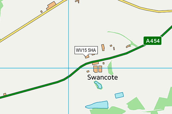
Swancote Health & Fitness Centre (Closed) on a map

Swancote Health & Fitness Centre (Closed) geodata
| Easting | 374143.29 |
| Northing | 294129.48 |
| Latitude | 52.544398 |
| Longitude | -2.382706 |
| Local Authority Name | Shropshire |
| Local Authority Code | E06000051 |
| Parliamentary Constituency Name | Ludlow |
| Parliamentary Constituency Code | E14000799 |
| Region Name | West Midlands |
| Region Code | E15000005 |
| Ward Name | Worfield |
| Ward Code | E05008198 |
| Output Area Code | E00146984 |
About this data
This data is open data sourced from Active Places Power and licenced under the Active Places Open Data Licence.
| Created On | 14th Dec 2014 |
| Audited On | 26th Jan 2015 |
| Checked On | 5th Nov 2008 |
