Suttonfields Golf Driving Range (Closed) - Sutton Weaver
Suttonfields Golf Driving Range (Closed) is located in Sutton Weaver, Runcorn (WA7).
| Address | Chester Road, Sutton Weaver, Runcorn, WA7 3EY |
| Management Type | Commercial Management |
| Management Group | Commercial |
| Owner Type | Commercial |
| Owner Group | Commercial |
| Education Phase | Not Known |
| Closure Date | 24th Aug 2016 |
| Closure Reason | Strategic Review - facility/site not being replaced |
Facilities
| Closure Date | 24th Aug 2016 |
| Closure Reason | Strategic Review - facility/site not being replaced |
| Accessibility | Pay and Play |
| Management Type | Commercial Management |
| Year Built | 1992 |
| Changing Rooms | No |
| Date Record Checked | 24th Aug 2016 |
Opening times
| Access description | Pay and Play |
|---|
| Opening time | 09:00 |
| Closing time | 18:00 |
| Period open for | Weekend |
| |
| Access description | Pay and Play |
|---|
| Opening time | 10:00 |
| Closing time | 21:00 |
| Period open for | Monday-Friday |
Facility specifics
Disabled access
| Disabled Access | Yes |
| Finding/Reaching Entrance | Yes |
| Reception Area | Yes |
| Doorways | Yes |
| Activity Areas | Yes |
| Disabled Toilets | Yes |
| Social Areas | Yes |
| Spectator Areas | Yes |
| Emergency Exits | Yes |
| Notes | Social Areas: lowered bar |
Contact
Disabled access
Disabled access for Suttonfields Golf Driving Range (Closed)
| Disabled Access | Yes |
| Finding/Reaching Entrance | Yes |
| Reception Area | Yes |
| Doorways | Yes |
| Activity Areas | Yes |
| Disabled Toilets | Yes |
| Social Areas | Yes |
| Spectator Areas | Yes |
| Emergency Exits | Yes |
| Notes | Lowered Pool Tables, Putting Greens, Crazy Golf all especially designed for Disables Users, Social Areas: lowered bar |
Where is Suttonfields Golf Driving Range (Closed)?
| Sub Building Name | |
| Building Name | |
| Building Number | 0 |
| Dependent Thoroughfare | |
| Thoroughfare Name | Chester Road |
| Double Dependent Locality | |
| Dependent Locality | Sutton Weaver |
| PostTown | Runcorn |
| Postcode | WA7 3EY |
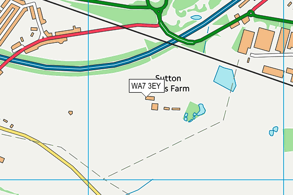
Suttonfields Golf Driving Range (Closed) on a map

Suttonfields Golf Driving Range (Closed) geodata
| Easting | 354484 |
| Northing | 379544 |
| Latitude | 53.310866 |
| Longitude | -2.684589 |
| Local Authority Name | Cheshire West and Chester |
| Local Authority Code | E06000050 |
| Parliamentary Constituency Name | Weaver Vale |
| Parliamentary Constituency Code | E14001024 |
| Region Name | North West |
| Region Code | E15000002 |
| Ward Name | Marbury |
| Ward Code | E05012225 |
| Output Area Code | E00094432 |
About this data
This data is open data sourced from Active Places Power and licenced under the Active Places Open Data Licence.
| Created On | 10th Jun 2004 |
| Audited On | 6th Aug 2015 |
| Checked On | 6th Aug 2015 |
