Stourport Cricket Club And Rugby Club - Stourport-on-severn
Stourport Cricket Club And Rugby Club is located in Stourport-on-severn (DY13), and offers Grass Pitches.
| Address | Dunley Road, Stourport-on-severn, DY13 0AA |
| Car Park | Yes |
| Car Park Capacity | 50 |
| Management Type | Sport Club |
| Management Group | Others |
| Owner Type | Local Authority |
| Owner Group | Local Authority |
| Education Phase | Not applicable |
Facilities
| Accessibility | Private Use |
| Management Type | Sport Club |
| Year Built | 1989 |
| Year Refurbished | 2009 |
| Changing Rooms | Yes |
| Year Changing Rooms Refurbished | 2009 |
| Date Record Checked | 9th Oct 2023 |
| Opening Times | Dawn To Dusk |
Facility specifics
Disabled access
| Disabled Access | Yes |
| Activity Areas | Yes |
| Accessibility | Private Use |
| Management Type | Sport Club |
| Year Built | 1989 |
| Year Refurbished | 2009 |
| Changing Rooms | Yes |
| Year Changing Rooms Refurbished | 2009 |
| Date Record Checked | 9th Oct 2023 |
Opening times
| Access description | Private Use |
|---|
| Opening time | 10:00 |
| Closing time | 22:00 |
| Period open for | Every day |
Facility specifics
Disabled access
| Disabled Access | Yes |
| Activity Areas | Yes |
| Status Notes | site has one grass pitch which includes an artificial practice wicket
|
| Accessibility | Private Use |
| Management Type | Sport Club |
| Year Refurbished | 2010 |
| Changing Rooms | Yes |
| Year Changing Rooms Refurbished | 1999 |
| Date Record Checked | 9th Oct 2023 |
| Opening Times | Dawn To Dusk |
Facility specifics
Disabled access
| Disabled Access | Yes |
| Activity Areas | Yes |
Contact
Disabled access
Disabled access for Stourport Cricket Club And Rugby Club
| Disabled Access | Yes |
| Activity Areas | Yes |
Where is Stourport Cricket Club And Rugby Club?
| Sub Building Name | |
| Building Name | |
| Building Number | 0 |
| Dependent Thoroughfare | |
| Thoroughfare Name | DUNLEY ROAD |
| Double Dependent Locality | |
| Dependent Locality | |
| PostTown | STOURPORT-ON-SEVERN |
| Postcode | DY13 0AA |
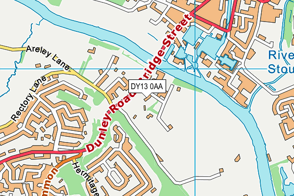
Stourport Cricket Club And Rugby Club on a map

Stourport Cricket Club And Rugby Club geodata
| Easting | 380869.7 |
| Northing | 270693.86 |
| Latitude | 52.333993 |
| Longitude | -2.282171 |
| Local Authority Name | Wyre Forest |
| Local Authority Code | E07000239 |
| Parliamentary Constituency Name | Wyre Forest |
| Parliamentary Constituency Code | E14001058 |
| Region Name | West Midlands |
| Region Code | E15000005 |
| Ward Name | Areley Kings & Riverside |
| Ward Code | E05010503 |
| Output Area Code | E00165371 |
About this data
This data is open data sourced from Active Places Power and licenced under the Active Places Open Data Licence.
| toid | osgb1000018865312 |
| Created On | 18th May 2007 |
| Audited On | 9th Oct 2023 |
| Checked On | 9th Oct 2023 |
