Stonegate Cricket Ground
Stonegate Cricket Ground is located in Stonegate (TN5), and offers Grass Pitches.
| Address | SPORTS FIELD, Cottenden Road, Stonegate, TN5 7DX |
| Car Park | Yes |
| Car Park Capacity | 50 |
| Management Type | Sport Club |
| Management Group | Others |
| Owner Type | Local Authority |
| Owner Group | Local Authority |
| Education Phase | Not applicable |
Facilities
| Status Notes | Currently the pavilion has hot and cold running water, showers in the male toilet, a separate ladies toilet, a small kitchen, 2 changing rooms and a store room. |
| Accessibility | Sports Club / Community Association |
| Management Type | Sport Club |
| Changing Rooms | Yes |
| Date Record Created | 24th Mar 2016 |
| Date Record Checked | 9th Aug 2023 |
| Opening Times | Dawn To Dusk |
Facility specifics
Disabled access
| Disabled Access | Yes |
| Activity Areas | Yes |
| Status Notes | Currently the pavilion has hot and cold running water, showers in the male toilet, a separate ladies toilet, a small kitchen, 2 changing rooms and a store room. |
| Accessibility | Sports Club / Community Association |
| Management Type | Sport Club |
| Changing Rooms | Yes |
| Date Record Created | 23rd Feb 2023 |
| Date Record Checked | 9th Aug 2023 |
| Opening Times | Dawn To Dusk |
Facility specifics
Disabled access
| Disabled Access | Yes |
| Activity Areas | Yes |
Contact
Where is Stonegate Cricket Ground?
| Sub Building Name | |
| Building Name | SPORTS FIELD |
| Building Number | 0 |
| Dependent Thoroughfare | |
| Thoroughfare Name | COTTENDEN ROAD |
| Double Dependent Locality | |
| Dependent Locality | |
| PostTown | STONEGATE |
| Postcode | TN5 7DX |
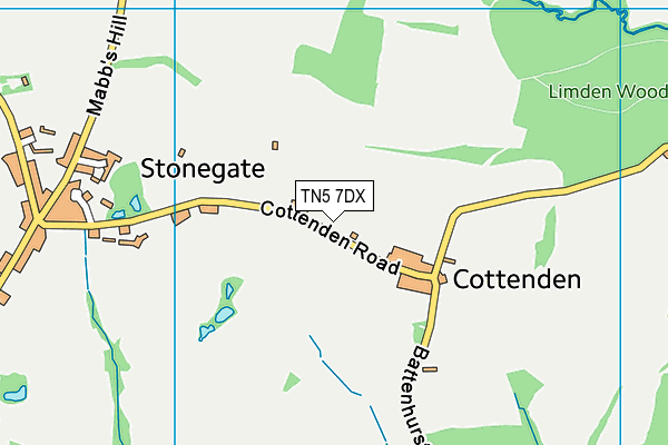
Stonegate Cricket Ground on a map

Stonegate Cricket Ground geodata
| Easting | 566994 |
| Northing | 128617 |
| Latitude | 51.032657 |
| Longitude | 0.380232 |
| Local Authority Name | Rother |
| Local Authority Code | E07000064 |
| Parliamentary Constituency Name | Bexhill and Battle |
| Parliamentary Constituency Code | E14000557 |
| Region Name | South East |
| Region Code | E15000008 |
| Ward Name | Hurst Green & Ticehurst |
| Ward Code | E05011617 |
| Output Area Code | E00107392 |
About this data
This data is open data sourced from Active Places Power and licenced under the Active Places Open Data Licence.
| toid | osgb1000001763204778 |
| Created On | 24th Mar 2016 |
| Audited On | 9th Aug 2023 |
| Checked On | 9th Aug 2023 |
