St Pancras Community Association - London
St Pancras Community Association is located in London (NW1), and offers Outdoor Tennis Courts.
| Address | 67, Plender Street, London, NW1 0LB |
| Management Type | Trust |
| Management Group | Trust |
| Owner Type | Local Authority |
| Owner Group | Local Authority |
| Education Phase | Not applicable |
Aliases
St Pancras Community Association is also known as:
- Richard Cobden Learning Centre
Facilities
| Status Notes | Multi Use Games Area - Overmarked with netball and football. School's playground during term time and term and schoool hours. No access during these times. |
| Accessibility | Pay and Play |
| Management Type | Trust |
| Year Built | 1999 |
| Year Refurbished | 2016 |
| Changing Rooms | Yes |
| Year Changing Rooms Refurbished | 2016 |
| Date Record Created | 6th May 2016 |
| Date Record Checked | 31st Jul 2023 |
Opening times
| Access description | Pay and Play |
|---|
| Opening time | 18:30 |
| Closing time | 21:30 |
| Period open for | Monday-Friday |
| |
| Access description | Pay and Play |
|---|
| Opening time | 10:00 |
| Closing time | 21:30 |
| Period open for | Weekend |
| |
| Access description | Private Use |
|---|
| Opening time | 08:00 |
| Closing time | 15:00 |
| Period open for | Monday-Friday |
Facility specifics
| Floodlit | Yes |
| Overmarked | No |
| Surface Type | Macadam |
Disabled access
| Disabled Access | Yes |
| Finding/Reaching Entrance | Yes |
| Reception Area | Yes |
| Doorways | Yes |
| Activity Areas | Yes |
| Disabled Toilets | Yes |
| Social Areas | Yes |
| Spectator Areas | Yes |
| Emergency Exits | Yes |
Contact
Disabled access
Disabled access for St Pancras Community Association
| Disabled Access | Yes |
| Finding/Reaching Entrance | Yes |
| Reception Area | Yes |
| Doorways | Yes |
| Activity Areas | Yes |
| Disabled Toilets | Yes |
| Social Areas | Yes |
| Spectator Areas | Yes |
| Emergency Exits | Yes |
Where is St Pancras Community Association?
| Sub Building Name | |
| Building Name | |
| Building Number | 67 |
| Dependent Thoroughfare | |
| Thoroughfare Name | PLENDER STREET |
| Double Dependent Locality | |
| Dependent Locality | |
| PostTown | LONDON |
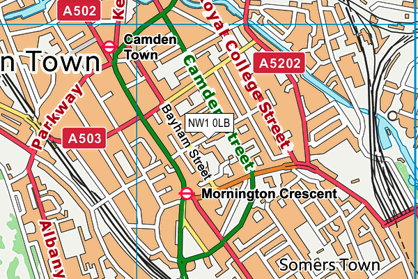
| Postcode | NW1 0LB |
St Pancras Community Association on a map

St Pancras Community Association geodata
| Easting | 529323.54 |
| Northing | 183577.55 |
| Latitude | 51.536296 |
| Longitude | -0.136783 |
| Local Authority Name | Camden |
| Local Authority Code | E09000007 |
| Parliamentary Constituency Name | Holborn and St Pancras |
| Parliamentary Constituency Code | E14000750 |
| Region Name | London |
| Region Code | E15000007 |
| Ward Name | St. Pancras & Somers Town |
| Ward Code | E05013669 |
| Output Area Code | E00004748 |
About this data
This data is open data sourced from Active Places Power and licenced under the Active Places Open Data Licence.
| toid | osgb5000005181897539 |
| Created On | 6th May 2016 |
| Audited On | 31st Jul 2023 |
| Checked On | 31st Jul 2023 |
