St Margarets Recreation Ground (Rec Park) - Birmingham
St Margarets Recreation Ground (Rec Park) is located in Birmingham (B8), and offers Artificial Grass Pitch.
| Address | ST MARGARETS RECREATION GROUND, St Margarets Road, Birmingham, B8 2DY |
| Management Type | Local Authority (in house) |
| Management Group | Local Authority |
| Owner Type | Local Authority |
| Owner Group | Local Authority |
| Education Phase | Not applicable |
Facilities
| Accessibility | Sports Club / Community Association |
| Management Type | Local Authority (in house) |
| Year Built | 2014 |
| Changing Rooms | No |
| Date Record Created | 25th Aug 2022 |
| Date Record Checked | 20th Oct 2023 |
| Opening Times | Dawn To Dusk |
Facility specifics
| Area | 1925m² |
| Floodlit | No |
| Indoor | No |
| Length | 55m |
| Width | 35m |
| WR22 Compliant Pitch | No |
Disabled access
| Disabled Access | Yes |
| Activity Areas | Yes |
| Accessibility | Free Public Access |
| Management Type | Local Authority (in house) |
| Year Built | 2014 |
| Changing Rooms | No |
| Date Record Created | 20th Oct 2023 |
| Date Record Checked | 20th Oct 2023 |
| Opening Times | Dawn To Dusk |
Facility specifics
| Area | 1386m² |
| Floodlit | No |
| Indoor | No |
| Length | 42m |
| Width | 33m |
| WR22 Compliant Pitch | No |
Disabled access
| Disabled Access | Yes |
| Activity Areas | Yes |
Contact
Disabled access
Disabled access for St Margarets Recreation Ground (Rec Park)
| Disabled Access | Yes |
| Activity Areas | Yes |
Where is St Margarets Recreation Ground (Rec Park)?
| Sub Building Name | |
| Building Name | ST MARGARETS RECREATION GROUND |
| Building Number | 0 |
| Dependent Thoroughfare | |
| Thoroughfare Name | ST MARGARETS ROAD |
| Double Dependent Locality | |
| Dependent Locality | |
| PostTown | BIRMINGHAM |
| Postcode | B8 2DY |
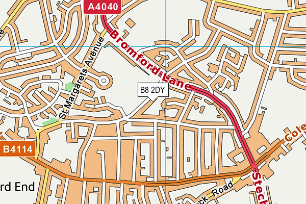
St Margarets Recreation Ground (Rec Park) on a map

St Margarets Recreation Ground (Rec Park) geodata
| Easting | 411841.07 |
| Northing | 288783 |
| Latitude | 52.496827 |
| Longitude | -1.827014 |
| Local Authority Name | Birmingham |
| Local Authority Code | E08000025 |
| Parliamentary Constituency Name | Birmingham, Hodge Hill |
| Parliamentary Constituency Code | E14000563 |
| Region Name | West Midlands |
| Region Code | E15000005 |
| Ward Name | Ward End |
| Ward Code | E05011183 |
| Output Area Code | E00047989 |
About this data
This data is open data sourced from Active Places Power and licenced under the Active Places Open Data Licence.
| toid | osgb1000002002449272 |
| Created On | 25th Aug 2022 |
| Audited On | 20th Oct 2023 |
| Checked On | 20th Oct 2023 |
