St Johns Park - Burgess Hill
St Johns Park is located in Burgess Hill (RH15), and offers Grass Pitches, and Outdoor Tennis Courts.
| Address | SKATEBOARD PARK, ST JOHNS PARK, Park Road, Burgess Hill, RH15 8LS |
| Car Park | Yes |
| Car Park Capacity | 30 |
| Management Type | Local Authority (in house) |
| Management Group | Local Authority |
| Owner Type | Local Authority |
| Owner Group | Local Authority |
| Education Phase | Not applicable |
Facilities
| Status Notes | Site has one grass pitch which includes an artificial wicket. |
| Accessibility | Pay and Play |
| Management Type | Local Authority (in house) |
| Changing Rooms | Yes |
| Year Changing Rooms Refurbished | 2020 |
| Date Record Checked | 27th Apr 2022 |
Opening times
| Access description | Pay and Play |
|---|
| Opening time | 09:00 |
| Closing time | 21:00 |
| Period open for | Every day |
Facility specifics
Disabled access
| Disabled Access | Yes |
| Disabled Parking | Yes |
| Finding/Reaching Entrance | Yes |
| Doorways | Yes |
| Disabled Changing Facilities | Yes |
| Activity Areas | Yes |
| Disabled Toilets | Yes |
| Social Areas | Yes |
| Emergency Exits | Yes |
| Accessibility | Pay and Play |
| Management Type | Local Authority (in house) |
| Year Built | 1970 |
| Year Refurbished | 2000 |
| Changing Rooms | No |
| Date Record Checked | 27th Apr 2022 |
| Opening Times | Dawn To Dusk |
Facility specifics
| Floodlit | No |
| Overmarked | No |
| Surface Type | Macadam |
Disabled access
| Disabled Access | Yes |
| Disabled Parking | Yes |
| Finding/Reaching Entrance | Yes |
| Doorways | Yes |
| Disabled Changing Facilities | Yes |
| Activity Areas | Yes |
| Disabled Toilets | Yes |
| Social Areas | Yes |
| Emergency Exits | Yes |
Contact
Disabled access
Disabled access for St Johns Park
| Disabled Access | Yes |
| Disabled Parking | Yes |
| Finding/Reaching Entrance | Yes |
| Doorways | Yes |
| Disabled Changing Facilities | Yes |
| Activity Areas | Yes |
| Disabled Toilets | Yes |
| Social Areas | Yes |
| Emergency Exits | Yes |
Where is St Johns Park?
| Sub Building Name | SKATEBOARD PARK |
| Building Name | ST JOHNS PARK |
| Building Number | 0 |
| Dependent Thoroughfare | |
| Thoroughfare Name | PARK ROAD |
| Double Dependent Locality | |
| Dependent Locality | |
| PostTown | BURGESS HILL |
| Postcode | RH15 8LS |
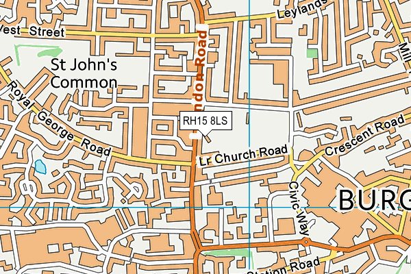
St Johns Park on a map

St Johns Park geodata
| Easting | 530863 |
| Northing | 119286 |
| Latitude | 50.958151 |
| Longitude | -0.138083 |
| Local Authority Name | Mid Sussex |
| Local Authority Code | E07000228 |
| Parliamentary Constituency Name | Mid Sussex |
| Parliamentary Constituency Code | E14000817 |
| Region Name | South East |
| Region Code | E15000008 |
| Ward Name | Burgess Hill Meeds |
| Ward Code | E05007674 |
| Output Area Code | E00161692 |
About this data
This data is open data sourced from Active Places Power and licenced under the Active Places Open Data Licence.
| toid | osgb5000005183185130 |
| Created On | 21st May 2007 |
| Audited On | 27th Apr 2022 |
| Checked On | 27th Apr 2022 |
