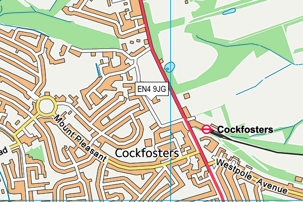
Southgate County Fc - Cockfosters
Southgate County Fc is located in Cockfosters, Barnet (EN4), and offers Grass Pitches.
| Address | Chalk Lane, Cockfosters, Barnet, EN4 9JG |
| Car Park | Yes |
| Car Park Capacity | 24 |
| Management Type | Other |
| Management Group | Others |
| Owner Type | Local Authority |
| Owner Group | Local Authority |
| Education Phase | Not applicable |
Aliases
Southgate County Fc is also known as:
Facilities
| Status Notes | 1 grass square inc an artificial wicket
|
| Accessibility | Private Use |
| Management Type | Other |
| Changing Rooms | Yes |
| Date Record Checked | 14th Apr 2023 |
| Opening Times | Dawn To Dusk |
Facility specifics
Disabled access
| Disabled Access | Yes |
| Finding/Reaching Entrance | Yes |
| Reception Area | Yes |
| Doorways | Yes |
| Activity Areas | Yes |
| Social Areas | Yes |
| Emergency Exits | Yes |
| Accessibility | Pay and Play |
| Management Type | Local Authority (in house) |
| Changing Rooms | Yes |
| Date Record Checked | 12th Apr 2022 |
| Opening Times | Dawn To Dusk |
Facility specifics
Disabled access
| Disabled Access | Yes |
| Finding/Reaching Entrance | Yes |
| Reception Area | Yes |
| Doorways | Yes |
| Activity Areas | Yes |
| Social Areas | Yes |
| Emergency Exits | Yes |
| Accessibility | Private Use |
| Management Type | Other |
| Changing Rooms | Yes |
| Date Record Created | 14th Apr 2023 |
| Date Record Checked | 14th Apr 2023 |
| Opening Times | Dawn To Dusk |
Facility specifics
Contact
Where is Southgate County Fc?
| Sub Building Name | |
| Building Name | |
| Building Number | 0 |
| Dependent Thoroughfare | |
| Thoroughfare Name | CHALK LANE |
| Double Dependent Locality | |
| Dependent Locality | COCKFOSTERS |
| PostTown | BARNET |
| Postcode | EN4 9JG |
Southgate County Fc on a map

Southgate County Fc geodata
| Easting | 527858.72 |
| Northing | 196578.5 |
| Latitude | 51.653465 |
| Longitude | -0.153158 |
| Local Authority Name | Enfield |
| Local Authority Code | E09000010 |
| Parliamentary Constituency Name | Enfield, Southgate |
| Parliamentary Constituency Code | E14000692 |
| Region Name | London |
| Region Code | E15000007 |
| Ward Name | Cockfosters |
| Ward Code | E05013678 |
| Output Area Code | E00007058 |
About this data
This data is open data sourced from Active Places Power and licenced under the Active Places Open Data Licence.
| toid | osgb5000005212396556 |
| Created On | 14th Apr 2023 |
| Audited On | 14th Apr 2023 |
| Checked On | 27th Apr 2023 |
