Shrewsbury House School - Surbiton
Shrewsbury House School is located in Surbiton (KT6), and offers Artificial Grass Pitch, and Swimming Pool.
| Address | 107, Ditton Road, Surbiton, KT6 6RL |
| Car Park | Yes |
| Car Park Capacity | 50 |
| Management Type | School/College/University (in house) |
| Management Group | Education |
| Owner Type | Other Independent School |
| Owner Group | Education |
| Education Phase | Primary |
Facilities
| Accessibility | Private Use |
| Management Type | School/College/University (in house) |
| Year Built | 2012 |
| Changing Rooms | No |
| Date Record Created | 18th Apr 2017 |
| Date Record Checked | 6th Feb 2023 |
Opening times
| Access description | Private Use |
|---|
| Opening time | 08:00 |
| Closing time | 16:30 |
| Period open for | Monday-Friday |
Facility specifics
| Area | 6512m² |
| Fill | Yes - Rubber |
| Floodlit | No |
| Indoor | No |
| Length | 88m |
| Pile Length | 40mm |
| Width | 74m |
| WR22 Compliant Pitch | No |
Disabled access
| Disabled Access | Yes |
| Finding/Reaching Entrance | Yes |
| Reception Area | Yes |
| Doorways | Yes |
| Emergency Exits | Yes |
| Status Notes | Covered by a glass dome |
| Accessibility | Private Use |
| Management Type | School/College/University (in house) |
| Year Built | 1980 |
| Year Refurbished | 2015 |
| Changing Rooms | Yes |
| Date Record Created | 21st Feb 2020 |
| Date Record Checked | 6th Feb 2023 |
Opening times
| Access description | Private Use |
|---|
| Opening time | 08:00 |
| Closing time | 16:30 |
| Period open for | Monday-Friday |
Facility specifics
| Access to Pool Hoist | No |
| Area | 90m² |
| Diving Boards | No |
| Length | 15m |
| Maximum Depth | 1.5m |
| Minimum Depth | 1m |
| Movable Floor | No |
| Width | 6m |
Disabled access
| Disabled Access | Yes |
| Finding/Reaching Entrance | Yes |
| Reception Area | Yes |
| Doorways | Yes |
| Emergency Exits | Yes |
Contact
Disabled access
Disabled access for Shrewsbury House School
| Disabled Access | Yes |
| Finding/Reaching Entrance | Yes |
| Reception Area | Yes |
| Doorways | Yes |
| Emergency Exits | Yes |
Where is Shrewsbury House School?
| Sub Building Name | |
| Building Name | |
| Building Number | 107 |
| Dependent Thoroughfare | |
| Thoroughfare Name | DITTON ROAD |
| Double Dependent Locality | |
| Dependent Locality | |
| PostTown | SURBITON |
| Postcode | KT6 6RL |
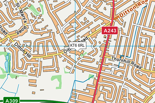
Shrewsbury House School on a map

Shrewsbury House School geodata
| Easting | 518024 |
| Northing | 165945 |
| Latitude | 51.380295 |
| Longitude | -0.3055 |
| Local Authority Name | Kingston upon Thames |
| Local Authority Code | E09000021 |
| Parliamentary Constituency Name | Kingston and Surbiton |
| Parliamentary Constituency Code | E14000770 |
| Region Name | London |
| Region Code | E15000007 |
| Ward Name | Surbiton Hill |
| Ward Code | E05013944 |
| Output Area Code | E00015090 |
About this data
This data is open data sourced from Active Places Power and licenced under the Active Places Open Data Licence.
| toid | osgb1000001790609625 |
| Created On | 18th Apr 2017 |
| Audited On | 6th Feb 2023 |
| Checked On | 6th Feb 2023 |
