Royal Norwich Golf Club Ltd (Closed)
Royal Norwich Golf Club Ltd (Closed) is located in Norwich (NR6).
| Address | Drayton High Road, Norwich, NR6 5AH |
| Car Park | Yes |
| Car Park Capacity | 150 |
| Management Type | Sport Club |
| Management Group | Others |
| Owner Type | Sports Club |
| Owner Group | Sports Club |
| Education Phase | Not applicable |
| Closure Date | 15th Sep 2019 |
| Closure Reason | Redevelopment - loss due to development project (e.g. major schemes such as HS2, new roads, area regeneration or smaller local development) |
Facilities
| Closure Date | 15th Sep 2019 |
| Closure Reason | Redevelopment - loss due to development project (e.g. major schemes such as HS2, new roads, area regeneration or smaller local development) |
| Accessibility | Pay and Play |
| Management Type | Sport Club |
| Year Built | 1893 |
| Year Refurbished | 2018 |
| Changing Rooms | Yes |
| Year Changing Rooms Refurbished | 1992 |
| Date Record Checked | 2nd Oct 2019 |
| Opening Times | Dawn To Dusk |
Facility specifics
Disabled access
| Disabled Access | Yes |
| Disabled Parking | Yes |
| Finding/Reaching Entrance | Yes |
| Reception Area | Yes |
| Doorways | Yes |
| Disabled Changing Facilities | Yes |
| Activity Areas | Yes |
| Disabled Toilets | Yes |
| Social Areas | Yes |
| Emergency Exits | Yes |
Contact
Disabled access
Disabled access for Royal Norwich Golf Club Ltd (Closed)
| Disabled Access | Yes |
| Disabled Parking | Yes |
| Finding/Reaching Entrance | Yes |
| Reception Area | Yes |
| Doorways | Yes |
| Disabled Changing Facilities | Yes |
| Activity Areas | Yes |
| Disabled Toilets | Yes |
| Social Areas | Yes |
| Emergency Exits | Yes |
| Notes | Buggy hire. |
Where is Royal Norwich Golf Club Ltd (Closed)?
| Sub Building Name | |
| Building Name | |
| Building Number | 0 |
| Dependent Thoroughfare | |
| Thoroughfare Name | DRAYTON HIGH ROAD |
| Double Dependent Locality | |
| Dependent Locality | |
| PostTown | NORWICH |
| Postcode | NR6 5AH |
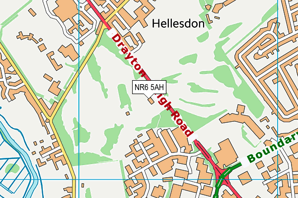
Royal Norwich Golf Club Ltd (Closed) on a map

Royal Norwich Golf Club Ltd (Closed) geodata
| Easting | 620355 |
| Northing | 311406 |
| Latitude | 52.655581 |
| Longitude | 1.256538 |
| Local Authority Name | Broadland |
| Local Authority Code | E07000144 |
| Parliamentary Constituency Name | Norwich North |
| Parliamentary Constituency Code | E14000863 |
| Region Name | Eastern |
| Region Code | E15000006 |
| Ward Name | Hellesdon North West |
| Ward Code | E05005768 |
| Output Area Code | E00134787 |
About this data
This data is open data sourced from Active Places Power and licenced under the Active Places Open Data Licence.
| toid | osgb1000008477906 |
| Created On | 26th Apr 2004 |
| Audited On | 25th Apr 2019 |
| Checked On | 25th Apr 2019 |
