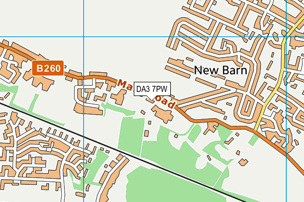
Rowhill School - Longfield
Rowhill School is located in Longfield (DA3), and offers Sports Hall.
| Address | Main Road, Longfield, DA3 7PW |
| Car Park | Yes |
| Car Park Capacity | 30 |
| Management Type | School/College/University (in house) |
| Management Group | Education |
| Owner Type | Community Special School |
| Owner Group | Education |
| Education Phase | Not applicable |
Facilities
| Accessibility | Private Use |
| Management Type | School/College/University (in house) |
| Changing Rooms | Yes |
| Date Record Created | 6th Apr 2018 |
| Date Record Checked | 6th Sep 2023 |
| Opening Times | Dawn To Dusk |
Facility specifics
Disabled access
| Disabled Access | Yes |
| Disabled Parking | Yes |
| Finding/Reaching Entrance | Yes |
| Reception Area | Yes |
| Doorways | Yes |
| Disabled Changing Facilities | Yes |
| Activity Areas | Yes |
| Disabled Toilets | Yes |
| Emergency Exits | Yes |
| Accessibility | Private Use |
| Management Type | School/College/University (in house) |
| Year Built | 1990 |
| Changing Rooms | Yes |
| Date Record Created | 1st Apr 2019 |
| Date Record Checked | 6th Sep 2023 |
Opening times
| Access description | Private Use |
|---|
| Opening time | 08:50 |
| Closing time | 15:30 |
| Period open for | Monday-Friday |
Facility specifics
| Area | 180m² |
| Floor Matting | Don't Know |
| Gymnastics Trampoline Use | Don't Know |
| Length | 18m |
| Moveable Balance Apparatus | Don't Know |
| Moveable Large Apparatus | Don't Know |
| Moveable Rebound Apparatus | Don't Know |
| Moveable Trampolines | Don't Know |
| Width | 10m |
| Small Apparatus | Don't Know |
| Swinging and Hanging Apparatus | Don't Know |
Disabled access
| Disabled Access | Yes |
| Disabled Parking | Yes |
| Finding/Reaching Entrance | Yes |
| Reception Area | Yes |
| Doorways | Yes |
| Disabled Changing Facilities | Yes |
| Activity Areas | Yes |
| Disabled Toilets | Yes |
| Emergency Exits | Yes |
Contact
Disabled access
Disabled access for Rowhill School
| Disabled Access | Yes |
| Disabled Parking | Yes |
| Finding/Reaching Entrance | Yes |
| Reception Area | Yes |
| Doorways | Yes |
| Disabled Changing Facilities | Yes |
| Activity Areas | Yes |
| Disabled Toilets | Yes |
| Emergency Exits | Yes |
Where is Rowhill School?
| Sub Building Name | |
| Building Name | |
| Building Number | 0 |
| Dependent Thoroughfare | |
| Thoroughfare Name | Main Road |
| Double Dependent Locality | |
| Dependent Locality | |
| PostTown | Longfield |
| Postcode | DA3 7PW |
Rowhill School on a map

Rowhill School geodata
| Easting | 561167.76 |
| Northing | 168722.39 |
| Latitude | 51.39465 |
| Longitude | 0.315222 |
| Local Authority Name | Dartford |
| Local Authority Code | E07000107 |
| Parliamentary Constituency Name | Dartford |
| Parliamentary Constituency Code | E14000659 |
| Region Name | South East |
| Region Code | E15000008 |
| Ward Name | Longfield, New Barn & Southfleet |
| Ward Code | E05012401 |
| Output Area Code | E00122648 |
About this data
This data is open data sourced from Active Places Power and licenced under the Active Places Open Data Licence.
| toid | osgb1000000741238 |
| Created On | 6th Apr 2018 |
| Audited On | 6th Sep 2023 |
| Checked On | 6th Sep 2023 |
