Rectory Farm Open Space - Northampton
Rectory Farm Open Space is located in Northampton (NN3), and offers Grass Pitches.
| Address | Rectory Farm Road, Northampton, NN3 5HZ |
| Management Type | Local Authority (in house) |
| Management Group | Local Authority |
| Owner Type | Local Authority |
| Owner Group | Local Authority |
| Education Phase | Not applicable |
Facilities
| Accessibility | Pay and Play |
| Management Type | Local Authority (in house) |
| Year Built | 1980 |
| Changing Rooms | No |
| Date Record Checked | 27th Oct 2022 |
| Opening Times | Dawn To Dusk |
Facility specifics
Disabled access
| Disabled Access | Yes |
| Activity Areas | Yes |
| Emergency Exits | Yes |
Contact
Disabled access
Disabled access for Rectory Farm Open Space
| Disabled Access | Yes |
| Activity Areas | Yes |
| Emergency Exits | Yes |
Where is Rectory Farm Open Space?
| Sub Building Name | |
| Building Name | |
| Building Number | 0 |
| Dependent Thoroughfare | |
| Thoroughfare Name | RECTORY FARM ROAD |
| Double Dependent Locality | |
| Dependent Locality | |
| PostTown | NORTHAMPTON |
| Postcode | NN3 5HZ |
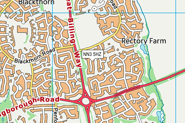
Rectory Farm Open Space on a map

Rectory Farm Open Space geodata
| Easting | 481322.31 |
| Northing | 263757.04 |
| Latitude | 52.265971 |
| Longitude | -0.809775 |
| Local Authority Name | West Northamptonshire |
| Local Authority Code | E06000062 |
| Parliamentary Constituency Name | Northampton South |
| Parliamentary Constituency Code | E14000862 |
| Region Name | East Midlands |
| Region Code | E15000004 |
| Ward Name | Billing and Rectory Farm |
| Ward Code | E05013240 |
| Output Area Code | E00138246 |
About this data
This data is open data sourced from Active Places Power and licenced under the Active Places Open Data Licence.
| Created On | 28th Sep 2005 |
| Audited On | 27th Oct 2022 |
| Checked On | 27th Oct 2022 |
