Raf Stafford (Closed)
Raf Stafford (Closed) is located in Stafford (ST18).
| Address | Beaconside, Stafford, ST18 0AQ |
| Car Park | Yes |
| Management Type | MOD |
| Management Group | Others |
| Owner Type | MOD |
| Owner Group | Others |
| Education Phase | Not Known |
| Closure Date | 1st Jul 2006 |
| Closure Reason | Unclassified |
Facilities
| Closure Date | 1st Jul 2006 |
| Closure Reason | Unclassified |
| Accessibility | Pay and Play |
| Management Type | MOD |
| Changing Rooms | Yes |
| Date Record Checked | 5th Jul 2007 |
| Opening Times | Detailed Timings |
Facility specifics
| Closure Date | 1st Jul 2006 |
| Closure Reason | Unclassified |
| Accessibility | Pay and Play |
| Management Type | MOD |
| Changing Rooms | Yes |
| Date Record Checked | 5th Jul 2007 |
| Opening Times | Detailed Timings |
Facility specifics
| Area | 486m² |
| Floor Matting | Don't Know |
| Gymnastics Trampoline Use | Don't Know |
| Length | 0m |
| Moveable Balance Apparatus | Don't Know |
| Moveable Large Apparatus | Don't Know |
| Moveable Rebound Apparatus | Don't Know |
| Width | 0m |
| Moveable Trampolines | Don't Know |
| Small Apparatus | Don't Know |
| Swinging and Hanging Apparatus | Don't Know |
| Closure Date | 1st Jul 2006 |
| Closure Reason | Unclassified |
| Accessibility | Pay and Play |
| Management Type | MOD |
| Date Record Checked | 5th Jul 2007 |
| Opening Times | Detailed Timings |
Facility specifics
| Closure Date | 1st Jul 2006 |
| Closure Reason | Unclassified |
| Accessibility | Not Known |
| Management Type | MOD |
| Date Record Checked | 5th Jul 2007 |
| Opening Times | Detailed Timings |
Facility specifics
Where is Raf Stafford (Closed)?
| Sub Building Name | |
| Building Name | |
| Building Number | 0 |
| Dependent Thoroughfare | |
| Thoroughfare Name | Beaconside |
| Double Dependent Locality | |
| Dependent Locality | |
| PostTown | Stafford |
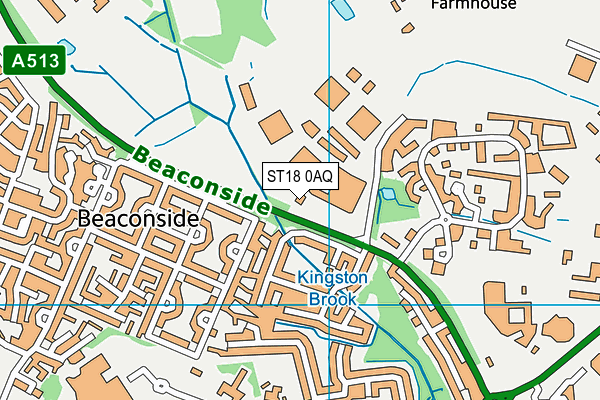
| Postcode | ST18 0AQ |
Raf Stafford (Closed) on a map

Raf Stafford (Closed) geodata
| Easting | 393930 |
| Northing | 324260 |
| Latitude | 52.815845 |
| Longitude | -2.091504 |
| Local Authority Name | Stafford |
| Local Authority Code | E07000197 |
| Parliamentary Constituency Name | Stafford |
| Parliamentary Constituency Code | E14000965 |
| Region Name | West Midlands |
| Region Code | E15000005 |
| Ward Name | Milwich |
| Ward Code | E05010494 |
| Output Area Code | E00168503 |
About this data
This data is open data sourced from Active Places Power and licenced under the Active Places Open Data Licence.
| Created On | 14th Dec 2014 |
| Audited On | 26th Jan 2015 |
| Checked On | 5th Jul 2007 |
