Powerleague Soccerdome (Blackburn) (Closed) - Guide
Powerleague Soccerdome (Blackburn) (Closed) is located in Guide, Blackburn (BB1).
| Address | Haslingden Road, Guide, Blackburn, BB1 2NG |
| Car Park | Yes |
| Car Park Capacity | 192 |
| Management Type | Commercial Management |
| Management Group | Commercial |
| Owner Type | Commercial |
| Owner Group | Commercial |
| Education Phase | Not Known |
| Start Date | 1st Nov 2004 |
| Closure Date | 18th Mar 2021 |
| Closure Reason | Strategic Review - facility/site not being replaced |
Facilities
| Closure Date | 18th Mar 2021 |
| Closure Reason | Strategic Review - facility/site not being replaced |
| Accessibility | Pay and Play |
| Management Type | Commercial Management |
| Year Built | 2004 |
| Changing Rooms | Yes |
| Date Record Checked | 26th Oct 2021 |
Opening times
| Access description | Pay and Play |
|---|
| Opening time | 09:00 |
| Closing time | 23:00 |
| Period open for | Monday-Friday |
| |
| Access description | Pay and Play |
|---|
| Opening time | 09:00 |
| Closing time | 17:00 |
| Period open for | Saturday |
| |
| Access description | Pay and Play |
|---|
| Opening time | 09:00 |
| Closing time | 21:00 |
| Period open for | Sunday |
Facility specifics
| Area | 748m² |
| Fill | Yes - Rubber |
| Floodlit | Yes |
| Indoor | Yes |
| Length | 34m |
| Pile Length | 30mm |
| Width | 22m |
| WR22 Compliant Pitch | No |
Disabled access
| Disabled Access | Yes |
| Disabled Parking | Yes |
| Finding/Reaching Entrance | Yes |
| Reception Area | Yes |
| Doorways | Yes |
| Disabled Changing Facilities | Yes |
| Activity Areas | Yes |
| Disabled Toilets | Yes |
| Social Areas | Yes |
| Spectator Areas | Yes |
| Emergency Exits | Yes |
Contact
Disabled access
Disabled access for Powerleague Soccerdome (Blackburn) (Closed)
| Disabled Access | Yes |
| Disabled Parking | Yes |
| Finding/Reaching Entrance | Yes |
| Reception Area | Yes |
| Doorways | Yes |
| Disabled Changing Facilities | Yes |
| Activity Areas | Yes |
| Disabled Toilets | Yes |
| Social Areas | Yes |
| Spectator Areas | Yes |
| Emergency Exits | Yes |
Where is Powerleague Soccerdome (Blackburn) (Closed)?
| Sub Building Name | |
| Building Name | |
| Building Number | 0 |
| Dependent Thoroughfare | |
| Thoroughfare Name | HASLINGDEN ROAD |
| Double Dependent Locality | |
| Dependent Locality | GUIDE |
| PostTown | BLACKBURN |
| Postcode | BB1 2NG |
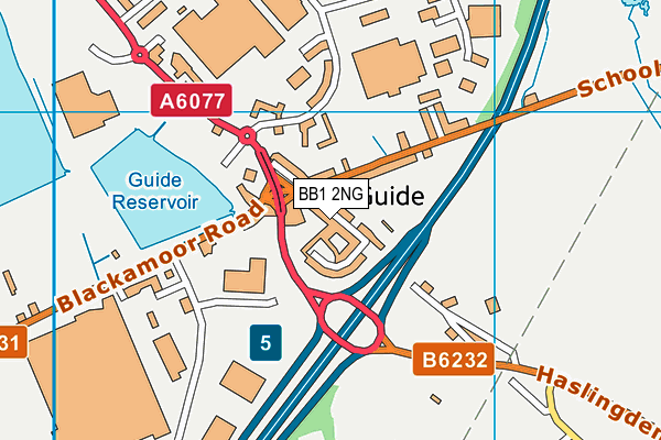
Powerleague Soccerdome (Blackburn) (Closed) on a map

Powerleague Soccerdome (Blackburn) (Closed) geodata
| Easting | 370052.39 |
| Northing | 426004.07 |
| Latitude | 53.729566 |
| Longitude | -2.455399 |
| Local Authority Name | Blackburn with Darwen |
| Local Authority Code | E06000008 |
| Parliamentary Constituency Name | Blackburn |
| Parliamentary Constituency Code | E14000570 |
| Region Name | North West |
| Region Code | E15000002 |
| Ward Name | Blackburn South East |
| Ward Code | E05011513 |
| Output Area Code | E00171893 |
About this data
This data is open data sourced from Active Places Power and licenced under the Active Places Open Data Licence.
| toid | osgb1000000215379559 |
| Created On | 10th Feb 2014 |
| Audited On | 16th Sep 2021 |
| Checked On | 16th Sep 2021 |
