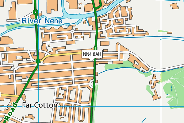
Playing Fields (Closed) - Northampton
Playing Fields (Closed) is located in Northampton (NN4).
| Address | London Road, Northampton, NN4 8AH |
| Car Park | Yes |
| Car Park Capacity | 31 |
| Management Type | Not Known |
| Management Group | Not Known |
| Owner Type | Community Organisation |
| Owner Group | Community Organisation |
| Education Phase | Not Known |
| Closure Date | 1st Jul 2006 |
| Closure Reason | Unclassified |
Facilities
| Closure Date | 1st Jul 2006 |
| Closure Reason | Unclassified |
| Accessibility | Pay and Play |
| Management Type | Not Known |
| Changing Rooms | Yes |
| Date Record Checked | 28th Jan 2009 |
| Opening Times | Detailed Timings |
Facility specifics
| Closure Date | 1st Jul 2006 |
| Closure Reason | Unclassified |
| Accessibility | Pay and Play |
| Management Type | Not Known |
| Changing Rooms | Yes |
| Date Record Checked | 28th Jan 2009 |
| Opening Times | Detailed Timings |
Facility specifics
Where is Playing Fields (Closed)?
| Sub Building Name | |
| Building Name | |
| Building Number | 0 |
| Dependent Thoroughfare | |
| Thoroughfare Name | London Road |
| Double Dependent Locality | |
| Dependent Locality | |
| PostTown | Northampton |
| Postcode | NN4 8AH |
Playing Fields (Closed) on a map

Playing Fields (Closed) geodata
| Easting | 475456 |
| Northing | 259284 |
| Latitude | 52.226599 |
| Longitude | -0.896716 |
| Local Authority Name | West Northamptonshire |
| Local Authority Code | E06000062 |
| Parliamentary Constituency Name | Northampton South |
| Parliamentary Constituency Code | E14000862 |
| Region Name | East Midlands |
| Region Code | E15000004 |
| Ward Name | Delapre and Rushmere |
| Ward Code | E05013251 |
| Output Area Code | E00138160 |
About this data
This data is open data sourced from Active Places Power and licenced under the Active Places Open Data Licence.
| Created On | 14th Dec 2014 |
| Audited On | 26th Jan 2015 |
| Checked On | 28th Jan 2009 |
