Platt Fields Park - Manchester
Platt Fields Park is located in Manchester (M14), and offers Outdoor Tennis Courts, and Cycling.
| Address | Albion Road, Manchester, M14 6LU |
| Car Park | Yes |
| Car Park Capacity | 60 |
| Management Type | Local Authority (in house) |
| Management Group | Local Authority |
| Owner Type | Local Authority |
| Owner Group | Local Authority |
| Education Phase | Not applicable |
Facilities
| Accessibility | Free Public Access |
| Management Type | Local Authority (in house) |
| Year Built | 2008 |
| Year Refurbished | 2023 |
| Changing Rooms | No |
| Date Record Checked | 28th Jun 2023 |
| Opening Times | Dawn To Dusk |
Facility specifics
| Floodlit | No |
| Overmarked | No |
| Surface Type | Macadam |
Disabled access
| Disabled Access | Yes |
| Disabled Parking | Yes |
| Activity Areas | Yes |
| Disabled Toilets | Yes |
| Accessibility | Free Public Access |
| Management Type | Sport Club |
| Year Built | 2008 |
| Changing Rooms | No |
| Date Record Created | 27th Feb 2017 |
| Date Record Checked | 10th Mar 2023 |
| Opening Times | Dawn To Dusk |
Facility specifics
| Automatic Start Gate | Yes |
| Finish Straight Length | 60m |
| Finish Straight Width | 6m |
| Floodlit | Yes |
| Overall Width | 6m |
| Start Gate | Yes |
| Start Hill Elevation | 1.5m |
| Start Hill Width | 10m |
| Start Straight Length | 50m |
| Start Straight Width | 9m |
| Surface | Macadam |
| Total Length | 340m |
Disabled access
| Disabled Access | Yes |
| Disabled Parking | Yes |
| Activity Areas | Yes |
| Disabled Toilets | Yes |
Contact
Disabled access
Disabled access for Platt Fields Park
| Disabled Access | Yes |
| Disabled Parking | Yes |
| Activity Areas | Yes |
| Disabled Toilets | Yes |
Where is Platt Fields Park?
| Sub Building Name | |
| Building Name | |
| Building Number | 0 |
| Dependent Thoroughfare | |
| Thoroughfare Name | ALBION ROAD |
| Double Dependent Locality | |
| Dependent Locality | |
| PostTown | MANCHESTER |
| Postcode | M14 6LU |
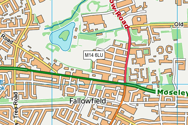
Platt Fields Park on a map

Platt Fields Park geodata
| Easting | 385250.38 |
| Northing | 394217.26 |
| Latitude | 53.444514 |
| Longitude | -2.223529 |
| Local Authority Name | Manchester |
| Local Authority Code | E08000003 |
| Parliamentary Constituency Name | Manchester, Gorton |
| Parliamentary Constituency Code | E14000808 |
| Region Name | North West |
| Region Code | E15000002 |
| Ward Name | Fallowfield |
| Ward Code | E05011364 |
| Output Area Code | E00026251 |
About this data
This data is open data sourced from Active Places Power and licenced under the Active Places Open Data Licence.
| toid | osgb1000024224391 |
| Created On | 10th Feb 2014 |
| Audited On | 10th Mar 2023 |
| Checked On | 28th Jun 2023 |
