Phoenix Community Centre (Closed) - London
Phoenix Community Centre (Closed) is located in London (SE19).
| Address | 66, Westow Street, London, SE19 3AF |
| Management Type | Local Authority (in house) |
| Management Group | Local Authority |
| Owner Type | Local Authority |
| Owner Group | Local Authority |
| Education Phase | Not applicable |
| Closure Date | 1st May 2020 |
| Closure Reason | Strategic Review - facility/site not being replaced |
Facilities
| Closure Date | 1st May 2020 |
| Closure Reason | Strategic Review - facility/site not being replaced |
| Accessibility | Sports Club / Community Association |
| Management Type | Local Authority (in house) |
| Year Built | 1984 |
| Changing Rooms | No |
| Date Record Checked | 26th May 2022 |
Opening times
| Access description | Sports Club / Community Association |
|---|
| Opening time | 09:00 |
| Closing time | 23:59 |
| Period open for | Weekend |
| |
| Access description | Sports Club / Community Association |
|---|
| Opening time | 09:00 |
| Closing time | 22:00 |
| Period open for | Monday-Friday |
Facility specifics
| Area | 198m² |
| Floor Matting | Don't Know |
| Gymnastics Trampoline Use | Don't Know |
| Length | 18m |
| Moveable Balance Apparatus | Don't Know |
| Moveable Large Apparatus | Don't Know |
| Moveable Rebound Apparatus | Don't Know |
| Moveable Trampolines | Don't Know |
| Width | 11m |
| Small Apparatus | Don't Know |
| Swinging and Hanging Apparatus | Don't Know |
Disabled access
| Disabled Access | Yes |
| Finding/Reaching Entrance | Yes |
| Reception Area | Yes |
| Doorways | Yes |
| Activity Areas | Yes |
| Disabled Toilets | Yes |
| Social Areas | Yes |
| Spectator Areas | Yes |
| Emergency Exits | Yes |
Contact
Disabled access
Disabled access for Phoenix Community Centre (Closed)
| Disabled Access | Yes |
| Finding/Reaching Entrance | Yes |
| Reception Area | Yes |
| Doorways | Yes |
| Activity Areas | Yes |
| Disabled Toilets | Yes |
| Social Areas | Yes |
| Spectator Areas | Yes |
| Emergency Exits | Yes |
Where is Phoenix Community Centre (Closed)?
| Sub Building Name | |
| Building Name | |
| Building Number | 66 |
| Dependent Thoroughfare | |
| Thoroughfare Name | WESTOW STREET |
| Double Dependent Locality | |
| Dependent Locality | |
| PostTown | LONDON |
| Postcode | SE19 3AF |
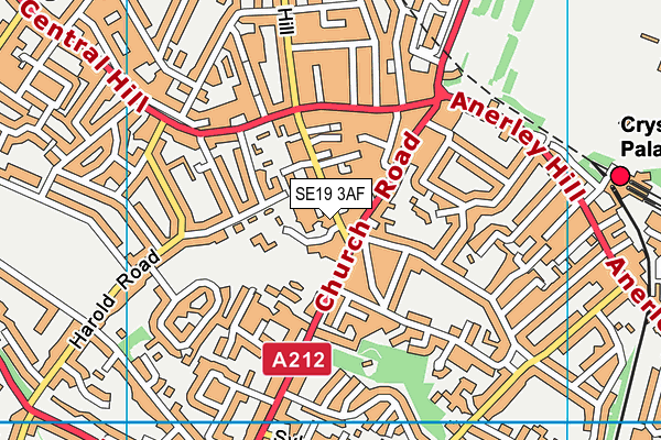
Phoenix Community Centre (Closed) on a map

Phoenix Community Centre (Closed) geodata
| Easting | 533464 |
| Northing | 170457 |
| Latitude | 51.417426 |
| Longitude | -0.082073 |
| Local Authority Name | Croydon |
| Local Authority Code | E09000008 |
| Parliamentary Constituency Name | Croydon North |
| Parliamentary Constituency Code | E14000655 |
| Region Name | London |
| Region Code | E15000007 |
| Ward Name | Crystal Palace & Upper Norwood |
| Ward Code | E05011467 |
| Output Area Code | E00005770 |
About this data
This data is open data sourced from Active Places Power and licenced under the Active Places Open Data Licence.
| toid | osgb1000006006271 |
| Created On | 23rd Aug 2004 |
| Audited On | 27th Oct 2021 |
| Checked On | 27th Oct 2021 |
