Philips Park Mtb Trail - Manchester
Philips Park Mtb Trail is located in Manchester (M11), and offers Cycling.
| Address | Sable Way, Manchester, M11 4SZ |
| Car Park | Yes |
| Car Park Capacity | 20 |
| Management Type | Local Authority (in house) |
| Management Group | Local Authority |
| Owner Type | Local Authority |
| Owner Group | Local Authority |
| Education Phase | Not applicable |
Facilities
| Accessibility | Free Public Access |
| Management Type | Local Authority (in house) |
| Year Built | 2005 |
| Changing Rooms | No |
| Date Record Created | 24th Feb 2017 |
| Date Record Checked | 14th Jul 2023 |
| Opening Times | Dawn To Dusk |
Facility specifics
| Bike Wash | No |
| Black Trails | No |
| Blue Trails | Yes |
| Extreme Trails | No |
| Green Trails | No |
| Length of Blue Trails | 1.695m |
| Length of Red Trails | 1.952m |
| Overall Width | 1m |
| Red Trails | Yes |
| Surface | Various |
| Total Length | 3647m |
Contact
Where is Philips Park Mtb Trail?
| Sub Building Name | |
| Building Name | |
| Building Number | 0 |
| Dependent Thoroughfare | |
| Thoroughfare Name | SABLE WAY |
| Double Dependent Locality | |
| Dependent Locality | |
| PostTown | MANCHESTER |
| Postcode | M11 4SZ |
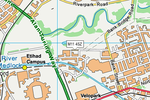
Philips Park Mtb Trail on a map

Philips Park Mtb Trail geodata
| Easting | 387244.25 |
| Northing | 399028.32 |
| Latitude | 53.48781 |
| Longitude | -2.193708 |
| Local Authority Name | Manchester |
| Local Authority Code | E08000003 |
| Parliamentary Constituency Name | Manchester Central |
| Parliamentary Constituency Code | E14000807 |
| Region Name | North West |
| Region Code | E15000002 |
| Ward Name | Clayton & Openshaw |
| Ward Code | E05011359 |
| Output Area Code | E00175876 |
About this data
This data is open data sourced from Active Places Power and licenced under the Active Places Open Data Licence.
| toid | osgb1000024305703 |
| Created On | 24th Feb 2017 |
| Audited On | 13th Mar 2023 |
| Checked On | 14th Jul 2023 |
