Peel Park - Little Hulton
Peel Park is located in Little Hulton, Manchester (M38), and offers Grass Pitches, Artificial Grass Pitch, and Cycling.
| Address | Manchester Road West, Little Hulton, Manchester, M38 0BT |
| Management Type | Local Authority (in house) |
| Management Group | Local Authority |
| Owner Type | Local Authority |
| Owner Group | Local Authority |
| Education Phase | Not applicable |
Facilities
| Accessibility | Sports Club / Community Association |
| Management Type | Sport Club |
| Changing Rooms | No |
| Date Record Checked | 26th Sep 2022 |
| Opening Times | Dawn To Dusk |
Facility specifics
Disabled access
| Disabled Access | Yes |
| Activity Areas | Yes |
| Status Notes | Cruyff Court. |
| Accessibility | Free Public Access |
| Management Type | Sport Club |
| Year Built | 2023 |
| Changing Rooms | No |
| Date Record Created | 21st Mar 2023 |
| Date Record Checked | 21st Mar 2023 |
| Opening Times | Dawn To Dusk |
Facility specifics
| Area | 594m² |
| Fill | None |
| Floodlit | No |
| Indoor | No |
| Length | 33m |
| Pile Length | 50mm |
| Width | 18m |
| WR22 Compliant Pitch | No |
Disabled access
| Disabled Access | Yes |
| Activity Areas | Yes |
| Accessibility | Free Public Access |
| Management Type | Local Authority (in house) |
| Year Built | 2021 |
| Changing Rooms | No |
| Date Record Created | 21st Mar 2023 |
| Date Record Checked | 21st Mar 2023 |
| Opening Times | Dawn To Dusk |
Facility specifics
| Automatic Start Gate | No |
| Floodlit | No |
| Overall Width | 3m |
| Start Gate | No |
| Surface | Macadam |
| Total Length | 100m |
Contact
Disabled access
Disabled access for Peel Park
| Disabled Access | Yes |
| Activity Areas | Yes |
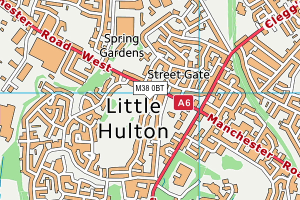
Where is Peel Park?
| Sub Building Name | |
| Building Name | |
| Building Number | 0 |
| Dependent Thoroughfare | |
| Thoroughfare Name | MANCHESTER ROAD WEST |
| Double Dependent Locality | |
| Dependent Locality | LITTLE HULTON |
| PostTown | MANCHESTER |
| Postcode | M38 0BT |
Peel Park on a map

Peel Park geodata
| Easting | 371632.98 |
| Northing | 403892.09 |
| Latitude | 53.530913 |
| Longitude | -2.429419 |
| Local Authority Name | Salford |
| Local Authority Code | E08000006 |
| Parliamentary Constituency Name | Worsley and Eccles South |
| Parliamentary Constituency Code | E14001054 |
| Region Name | North West |
| Region Code | E15000002 |
| Ward Name | Little Hulton |
| Ward Code | E05013027 |
| Output Area Code | E00028645 |
About this data
This data is open data sourced from Active Places Power and licenced under the Active Places Open Data Licence.
| toid | osgb1000028725677 |
| Created On | 28th Sep 2005 |
| Audited On | 26th Sep 2022 |
| Checked On | 21st Mar 2023 |
