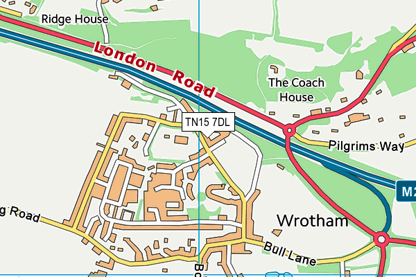
Old London Road Recreation Ground - Wrotham
Old London Road Recreation Ground is located in Wrotham, Sevenoaks (TN15), and offers Grass Pitches.
| Address | Old London Road, Wrotham, Sevenoaks, TN15 7DL |
| Management Type | Local Authority (in house) |
| Management Group | Local Authority |
| Owner Type | Local Authority |
| Owner Group | Local Authority |
| Education Phase | Not applicable |
Facilities
| Status Notes | Pavilion has changing facilities/showers for 2 teams and separate facilities/shower for referees. |
| Accessibility | Sports Club / Community Association |
| Management Type | Local Authority (in house) |
| Changing Rooms | Yes |
| Date Record Checked | 6th Sep 2022 |
| Opening Times | Dawn To Dusk |
Facility specifics
Disabled access
| Disabled Access | Yes |
| Finding/Reaching Entrance | Yes |
| Reception Area | Yes |
| Doorways | Yes |
| Activity Areas | Yes |
| Disabled Toilets | Yes |
| Emergency Exits | Yes |
| Notes | Area is open space with on road parking. Nearby sports pavilion can be hired to use in conjunction with pitch. Pavilion has disabled access and toilets |
Contact
Disabled access
Disabled access for Old London Road Recreation Ground
| Disabled Access | Yes |
| Finding/Reaching Entrance | Yes |
| Reception Area | Yes |
| Doorways | Yes |
| Activity Areas | Yes |
| Disabled Toilets | Yes |
| Emergency Exits | Yes |
| Notes | Area is open space with on road parking. Nearby sports pavilion can be hired to use in conjunction with pitch. Pavilion has disabled access and toilets |
Where is Old London Road Recreation Ground?
| Sub Building Name | |
| Building Name | |
| Building Number | 0 |
| Dependent Thoroughfare | |
| Thoroughfare Name | OLD LONDON ROAD |
| Double Dependent Locality | |
| Dependent Locality | WROTHAM |
| PostTown | SEVENOAKS |
| Postcode | TN15 7DL |
Old London Road Recreation Ground on a map

Old London Road Recreation Ground geodata
| Easting | 561132.19 |
| Northing | 159435.74 |
| Latitude | 51.311226 |
| Longitude | 0.310508 |
| Local Authority Name | Tonbridge and Malling |
| Local Authority Code | E07000115 |
| Parliamentary Constituency Name | Tonbridge and Malling |
| Parliamentary Constituency Code | E14000997 |
| Region Name | South East |
| Region Code | E15000008 |
| Ward Name | Wrotham, Ightham and Stansted |
| Ward Code | E05009591 |
| Output Area Code | E00125806 |
About this data
This data is open data sourced from Active Places Power and licenced under the Active Places Open Data Licence.
| Created On | 18th May 2007 |
| Audited On | 6th Sep 2022 |
| Checked On | 6th Sep 2022 |
