Oast Park Golf Club (Closed) - Snodland
Oast Park Golf Club (Closed) is located in Snodland (ME6).
| Address | Sandhole, Snodland, ME6 5LG |
| Car Park | Yes |
| Car Park Capacity | 100 |
| Management Type | Commercial Management |
| Management Group | Commercial |
| Owner Type | Commercial |
| Owner Group | Commercial |
| Education Phase | Not applicable |
| Closure Date | 27th Apr 2017 |
| Closure Reason | Unrepairable - fire damage |
Aliases
Oast Park Golf Club (Closed) is also known as:
Facilities
| Closure Date | 27th Apr 2017 |
| Closure Reason | Unrepairable - fire damage |
| Accessibility | Pay and Play |
| Management Type | Commercial Management |
| Year Built | 1992 |
| Changing Rooms | Yes |
| Date Record Checked | 27th Apr 2017 |
Opening times
| Access description | Pay and Play |
|---|
| Opening time | 09:00 |
| Closing time | 21:00 |
| Period open for | Monday-Friday |
| |
| Access description | Pay and Play |
|---|
| Opening time | 09:00 |
| Closing time | 19:00 |
| Period open for | Weekend |
Facility specifics
Disabled access
| Disabled Access | Yes |
| Finding/Reaching Entrance | Yes |
| Emergency Exits | Yes |
| Closure Date | 27th Apr 2017 |
| Closure Reason | Unrepairable - fire damage |
| Accessibility | Pay and Play |
| Management Type | Commercial Management |
| Year Built | 1992 |
| Changing Rooms | Yes |
| Date Record Checked | 27th Apr 2017 |
| Opening Times | Dawn To Dusk |
Facility specifics
Disabled access
| Disabled Access | Yes |
| Finding/Reaching Entrance | Yes |
| Emergency Exits | Yes |
Contact
Disabled access
Disabled access for Oast Park Golf Club (Closed)
| Disabled Access | Yes |
| Finding/Reaching Entrance | Yes |
| Emergency Exits | Yes |
Where is Oast Park Golf Club (Closed)?
| Sub Building Name | |
| Building Name | |
| Building Number | 0 |
| Dependent Thoroughfare | |
| Thoroughfare Name | Sandhole |
| Double Dependent Locality | |
| Dependent Locality | |
| PostTown | Snodland |
| Postcode | ME6 5LG |
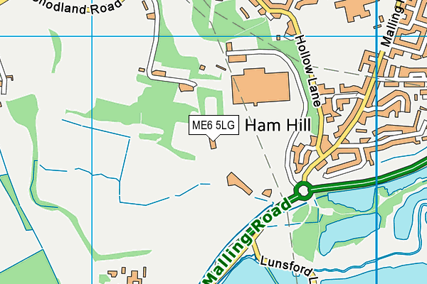
Oast Park Golf Club (Closed) on a map

Oast Park Golf Club (Closed) geodata
| Easting | 569483.4 |
| Northing | 160490.8 |
| Latitude | 51.31828 |
| Longitude | 0.430718 |
| Local Authority Name | Tonbridge and Malling |
| Local Authority Code | E07000115 |
| Parliamentary Constituency Name | Tonbridge and Malling |
| Parliamentary Constituency Code | E14000997 |
| Region Name | South East |
| Region Code | E15000008 |
| Ward Name | Downs and Mereworth |
| Ward Code | E05009575 |
| Output Area Code | E00125570 |
About this data
This data is open data sourced from Active Places Power and licenced under the Active Places Open Data Licence.
| Created On | 26th Apr 2004 |
| Audited On | 19th May 2016 |
| Checked On | 25th Apr 2017 |
