North Frodingham Playing Fields
North Frodingham Playing Fields is located in North Frodingham, Driffield (YO25), and offers Grass Pitches.
| Address | South Townside Road, North Frodingham, Driffield, YO25 8LE |
| Car Park | Yes |
| Car Park Capacity | 25 |
| Management Type | Community Organisation |
| Management Group | Others |
| Owner Type | Community Organisation |
| Owner Group | Community Organisation |
| Education Phase | Not applicable |
Facilities
| Accessibility | Sports Club / Community Association |
| Management Type | Community Organisation |
| Year Built | 1985 |
| Changing Rooms | Yes |
| Date Record Checked | 3rd May 2022 |
| Opening Times | Dawn To Dusk |
Facility specifics
Disabled access
| Disabled Access | Yes |
| Disabled Parking | Yes |
Contact
Disabled access
Disabled access for North Frodingham Playing Fields
| Disabled Access | Yes |
| Disabled Parking | Yes |
| Notes | There are no marked dedicated accessible parking spaces, but there is a wheelchair gate allowing access to the field. The changing rooms are not accessible with level access. There is level access to the toilets but they are not designed as accessible toilets. |
Where is North Frodingham Playing Fields?
| Sub Building Name | |
| Building Name | |
| Building Number | 0 |
| Dependent Thoroughfare | |
| Thoroughfare Name | South Townside Road |
| Double Dependent Locality | |
| Dependent Locality | North Frodingham |
| PostTown | Driffield |
| Postcode | YO25 8LE |
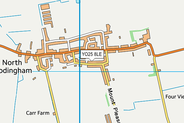
North Frodingham Playing Fields on a map

North Frodingham Playing Fields geodata
| Easting | 510426.32 |
| Northing | 453002.59 |
| Latitude | 53.961327 |
| Longitude | -0.3184 |
| Local Authority Name | East Riding of Yorkshire |
| Local Authority Code | E06000011 |
| Parliamentary Constituency Name | East Yorkshire |
| Parliamentary Constituency Code | E14000683 |
| Region Name | Yorkshire and the Humber |
| Region Code | E15000003 |
| Ward Name | East Wolds and Coastal |
| Ward Code | E05001695 |
| Output Area Code | E00065536 |
About this data
This data is open data sourced from Active Places Power and licenced under the Active Places Open Data Licence.
| Created On | 5th Feb 2007 |
| Audited On | 3rd May 2022 |
| Checked On | 3rd May 2022 |
