Mollington Village Hall
Mollington Village Hall is located in Mollington (OX17), and offers Sports Hall.
| Address | MOLLINGTON VILLAGE HALL, Chestnut Road, Mollington, OX17 1BG |
| Management Type | Community Organisation |
| Management Group | Others |
| Owner Type | Local Authority |
| Owner Group | Local Authority |
| Education Phase | Not applicable |
Facilities
| Accessibility | Sports Club / Community Association |
| Management Type | Community Organisation |
| Year Built | 1999 |
| Changing Rooms | No |
| Date Record Checked | 25th Apr 2023 |
Opening times
| Access description | Sports Club / Community Association |
|---|
| Opening time | 09:00 |
| Closing time | 23:59 |
| Period open for | Weekend |
| |
| Access description | Sports Club / Community Association |
|---|
| Opening time | 09:00 |
| Closing time | 22:00 |
| Period open for | Monday-Friday |
Facility specifics
| Area | 180m² |
| Floor Matting | Don't Know |
| Gymnastics Trampoline Use | Don't Know |
| Length | 18m |
| Moveable Balance Apparatus | Don't Know |
| Moveable Large Apparatus | Don't Know |
| Moveable Rebound Apparatus | Don't Know |
| Moveable Trampolines | Don't Know |
| Width | 10m |
| Small Apparatus | Don't Know |
| Swinging and Hanging Apparatus | Don't Know |
Contact
Where is Mollington Village Hall?
| Sub Building Name | |
| Building Name | MOLLINGTON VILLAGE HALL |
| Building Number | 0 |
| Dependent Thoroughfare | |
| Thoroughfare Name | CHESTNUT ROAD |
| Double Dependent Locality | |
| Dependent Locality | |
| PostTown | MOLLINGTON |
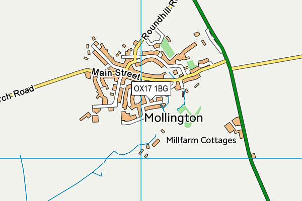
| Postcode | OX17 1BG |
Mollington Village Hall on a map

Mollington Village Hall geodata
| Easting | 443968 |
| Northing | 247202 |
| Latitude | 52.121392 |
| Longitude | -1.359231 |
| Local Authority Name | Cherwell |
| Local Authority Code | E07000177 |
| Parliamentary Constituency Name | Banbury |
| Parliamentary Constituency Code | E14000539 |
| Region Name | South East |
| Region Code | E15000008 |
| Ward Name | Cropredy, Sibfords & Wroxton |
| Ward Code | E05010929 |
| Output Area Code | E00145118 |
About this data
This data is open data sourced from Active Places Power and licenced under the Active Places Open Data Licence.
| toid | osgb1000017362549 |
| Created On | 10th Feb 2014 |
| Audited On | 25th Apr 2023 |
| Checked On | 25th Apr 2023 |
