Milefield Primary School - Grimethorpe
Milefield Primary School is located in Grimethorpe, Barnsley (S72), and offers Grass Pitches.
| Address | MILEFIELD PRIMARY SCHOOL, Milefield Lane, Grimethorpe, Barnsley, S72 7BH |
| Car Park | Yes |
| Car Park Capacity | 35 |
| Management Type | School/College/University (in house) |
| Management Group | Education |
| Owner Type | Community school |
| Owner Group | Education |
| Education Phase | Primary |
Facilities
| Accessibility | Private Use |
| Management Type | School/College/University (in house) |
| Year Built | 1975 |
| Changing Rooms | No |
| Date Record Checked | 27th Sep 2023 |
Opening times
| Access description | Private Use |
|---|
| Opening time | 08:30 |
| Closing time | 17:00 |
| Period open for | Monday-Friday |
Facility specifics
Disabled access
| Disabled Access | Yes |
| Disabled Parking | Yes |
| Finding/Reaching Entrance | Yes |
| Reception Area | Yes |
| Doorways | Yes |
| Activity Areas | Yes |
| Disabled Toilets | Yes |
| Emergency Exits | Yes |
Contact
Disabled access
Disabled access for Milefield Primary School
| Disabled Access | Yes |
| Disabled Parking | Yes |
| Finding/Reaching Entrance | Yes |
| Reception Area | Yes |
| Doorways | Yes |
| Activity Areas | Yes |
| Disabled Toilets | Yes |
| Emergency Exits | Yes |
Where is Milefield Primary School?
| Sub Building Name | |
| Building Name | MILEFIELD PRIMARY SCHOOL |
| Building Number | 0 |
| Dependent Thoroughfare | |
| Thoroughfare Name | MILEFIELD LANE |
| Double Dependent Locality | |
| Dependent Locality | GRIMETHORPE |
| PostTown | BARNSLEY |
| Postcode | S72 7BH |
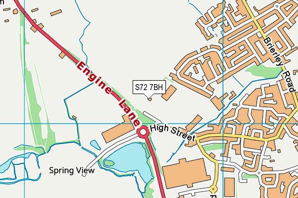
Milefield Primary School on a map

Milefield Primary School geodata
| Easting | 440727 |
| Northing | 409152 |
| Latitude | 53.577391 |
| Longitude | -1.386384 |
| Local Authority Name | Barnsley |
| Local Authority Code | E08000016 |
| Parliamentary Constituency Name | Barnsley East |
| Parliamentary Constituency Code | E14000542 |
| Region Name | Yorkshire and the Humber |
| Region Code | E15000003 |
| Ward Name | North East |
| Ward Code | E05000987 |
| Output Area Code | E00037146 |
About this data
This data is open data sourced from Active Places Power and licenced under the Active Places Open Data Licence.
| toid | osgb1000033109475 |
| Created On | 13th Oct 2006 |
| Audited On | 27th Sep 2023 |
| Checked On | 27th Sep 2023 |
