Mcgovern Parks (Closed) - Sale
Mcgovern Parks (Closed) is located in Sale (M33).
| Address | Rifle Road, Sale, M33 2LX |
| Car Park | Yes |
| Car Park Capacity | 51 |
| Management Type | Sport Club |
| Management Group | Others |
| Owner Type | Sports Club |
| Owner Group | Sports Club |
| Education Phase | Not Known |
| Closure Date | 1st Oct 2009 |
| Closure Reason | Unclassified |
Facilities
| Closure Date | 1st Oct 2009 |
| Closure Reason | Unclassified |
| Accessibility | Private Use |
| Management Type | Not Known |
| Changing Rooms | Yes |
| Date Record Checked | 20th Jul 2015 |
| Opening Times | Detailed Timings |
Facility specifics
Contact
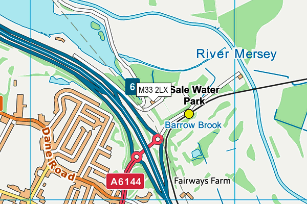
Where is Mcgovern Parks (Closed)?
| Sub Building Name | |
| Building Name | |
| Building Number | 0 |
| Dependent Thoroughfare | |
| Thoroughfare Name | Rifle Road |
| Double Dependent Locality | |
| Dependent Locality | |
| PostTown | Sale |
| Postcode | M33 2LX |
Mcgovern Parks (Closed) on a map

Mcgovern Parks (Closed) geodata
| Easting | 380707.45 |
| Northing | 392484.62 |
| Latitude | 53.428793 |
| Longitude | -2.291818 |
| Local Authority Name | Trafford |
| Local Authority Code | E08000009 |
| Parliamentary Constituency Name | Wythenshawe and Sale East |
| Parliamentary Constituency Code | E14001059 |
| Region Name | North West |
| Region Code | E15000002 |
| Ward Name | Priory |
| Ward Code | E05000833 |
| Output Area Code | E00031241 |
About this data
This data is open data sourced from Active Places Power and licenced under the Active Places Open Data Licence.
| Created On | 28th Sep 2005 |
| Audited On | 26th Jan 2015 |
| Checked On | 20th Jul 2015 |
