Marshland Hall - Marshland St. James
Marshland Hall is located in Marshland St. James, Wisbech (PE14), and offers Grass Pitches, and Outdoor Tennis Courts.
| Address | 156-158, Smeeth Road, Marshland St. James, Wisbech, PE14 8JB |
| Car Park | Yes |
| Car Park Capacity | 40 |
| Management Type | Community Organisation |
| Management Group | Others |
| Owner Type | Community Organisation |
| Owner Group | Community Organisation |
| Education Phase | Not applicable |
Facilities
| Accessibility | Sports Club / Community Association |
| Management Type | Community Organisation |
| Changing Rooms | Yes |
| Year Changing Rooms Refurbished | 2018 |
| Date Record Created | 27th Apr 2018 |
| Date Record Checked | 9th Oct 2023 |
| Opening Times | Dawn To Dusk |
Facility specifics
Disabled access
| Disabled Access | Yes |
| Disabled Parking | Yes |
| Finding/Reaching Entrance | Yes |
| Reception Area | Yes |
| Doorways | Yes |
| Activity Areas | Yes |
| Disabled Toilets | Yes |
| Emergency Exits | Yes |
| Status Notes | Over marked with basketball and skateboarding. |
| Accessibility | Sports Club / Community Association |
| Management Type | Community Organisation |
| Year Built | 1999 |
| Changing Rooms | Yes |
| Date Record Created | 27th Apr 2018 |
| Date Record Checked | 9th Oct 2023 |
| Opening Times | Dawn To Dusk |
Facility specifics
| Floodlit | No |
| Overmarked | Yes |
| Surface Type | Concrete |
Disabled access
| Disabled Access | Yes |
| Disabled Parking | Yes |
| Finding/Reaching Entrance | Yes |
| Reception Area | Yes |
| Doorways | Yes |
| Activity Areas | Yes |
| Disabled Toilets | Yes |
| Emergency Exits | Yes |
Contact
Disabled access
Disabled access for Marshland Hall
| Disabled Access | Yes |
| Disabled Parking | Yes |
| Finding/Reaching Entrance | Yes |
| Reception Area | Yes |
| Doorways | Yes |
| Activity Areas | Yes |
| Disabled Toilets | Yes |
| Emergency Exits | Yes |
Where is Marshland Hall?
| Sub Building Name | |
| Building Name | 156-158 |
| Building Number | 0 |
| Dependent Thoroughfare | |
| Thoroughfare Name | SMEETH ROAD |
| Double Dependent Locality | |
| Dependent Locality | MARSHLAND ST. JAMES |
| PostTown | WISBECH |
| Postcode | PE14 8JB |
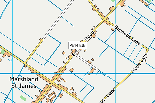
Marshland Hall on a map

Marshland Hall geodata
| Easting | 552685.12 |
| Northing | 310388.33 |
| Latitude | 52.669702 |
| Longitude | 0.256592 |
| Local Authority Name | King's Lynn and West Norfolk |
| Local Authority Code | E07000146 |
| Parliamentary Constituency Name | South West Norfolk |
| Parliamentary Constituency Code | E14000952 |
| Region Name | Eastern |
| Region Code | E15000006 |
| Ward Name | Tilney, Mershe Lande & Wiggenhall |
| Ward Code | E05012350 |
| Output Area Code | E00135621 |
About this data
This data is open data sourced from Active Places Power and licenced under the Active Places Open Data Licence.
| toid | osgb5000005140026536 |
| Created On | 27th Apr 2018 |
| Audited On | 9th Oct 2023 |
| Checked On | 9th Oct 2023 |
