Liss Junior School
Liss Junior School is located in Liss (GU33), and offers Grass Pitches.
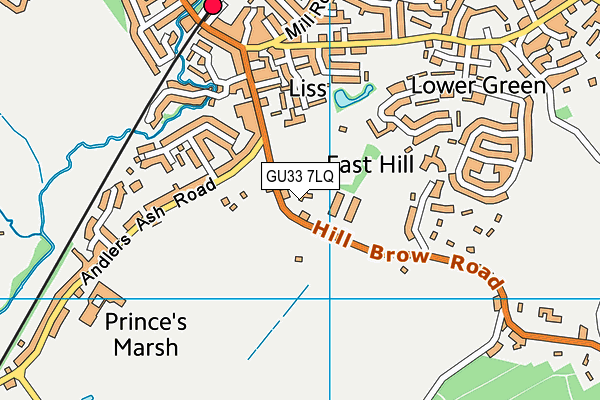
| Address | Hill Brow Road, Liss, GU33 7LQ |
| Car Park | Yes |
| Car Park Capacity | 60 |
| Management Type | School/College/University (in house) |
| Management Group | Education |
| Owner Type | Community school |
| Owner Group | Education |
| Education Phase | Primary |
Facilities
| Accessibility | Private Use |
| Management Type | School/College/University (in house) |
| Changing Rooms | Yes |
| Date Record Created | 23rd May 2016 |
| Date Record Checked | 5th Oct 2023 |
Opening times
| Access description | Private Use |
|---|
| Opening time | 09:00 |
| Closing time | 15:30 |
| Period open for | Monday-Friday |
Facility specifics
Disabled access
| Disabled Access | Yes |
| Disabled Parking | Yes |
| Finding/Reaching Entrance | Yes |
| Reception Area | Yes |
| Doorways | Yes |
| Activity Areas | Yes |
| Disabled Toilets | Yes |
| Social Areas | Yes |
| Spectator Areas | Yes |
| Emergency Exits | Yes |
Contact
Disabled access
Disabled access for Liss Junior School
| Disabled Access | Yes |
| Disabled Parking | Yes |
| Finding/Reaching Entrance | Yes |
| Reception Area | Yes |
| Doorways | Yes |
| Activity Areas | Yes |
| Disabled Toilets | Yes |
| Social Areas | Yes |
| Spectator Areas | Yes |
| Emergency Exits | Yes |
Where is Liss Junior School?
| Sub Building Name | |
| Building Name | |
| Building Number | 0 |
| Dependent Thoroughfare | |
| Thoroughfare Name | HILL BROW ROAD |
| Double Dependent Locality | |
| Dependent Locality | |
| PostTown | LISS |
| Postcode | GU33 7LQ |
Liss Junior School on a map

Liss Junior School geodata
| Easting | 478069.4 |
| Northing | 127242.1 |
| Latitude | 51.039242 |
| Longitude | -0.887873 |
| Local Authority Name | East Hampshire |
| Local Authority Code | E07000085 |
| Parliamentary Constituency Name | East Hampshire |
| Parliamentary Constituency Code | E14000680 |
| Region Name | South East |
| Region Code | E15000008 |
| Ward Name | Liss |
| Ward Code | E05012311 |
| Output Area Code | E00114982 |
About this data
This data is open data sourced from Active Places Power and licenced under the Active Places Open Data Licence.
| toid | osgb1000014351189 |
| Created On | 23rd May 2016 |
| Audited On | 5th Oct 2023 |
| Checked On | 5th Oct 2023 |
