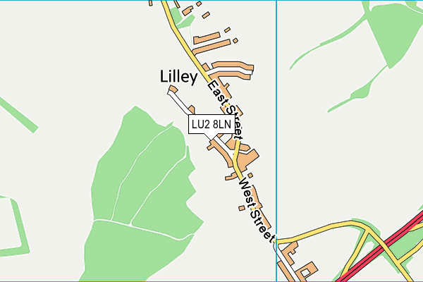
Lilley Recreation Ground
Lilley Recreation Ground is located in Lilley, Luton (LU2).
| Address | West Street, Lilley, Luton, LU2 8LN |
| Car Park | Yes |
| Car Park Capacity | 30 |
| Management Type | Sport Club |
| Management Group | Others |
| Owner Type | Local Authority |
| Owner Group | Local Authority |
| Education Phase | Not applicable |
Aliases
Lilley Recreation Ground is also known as:
Facilities
| Status Notes | Local football club now uses pitch in adjacent field to this site. Junior Football is played here now and pitches marked out as and when required by another club. |
| Accessibility | Sports Club / Community Association |
| Management Type | Sport Club |
| Year Built | 1954 |
| Changing Rooms | No |
| Date Record Checked | 23rd Mar 2023 |
| Opening Times | Dawn To Dusk |
Facility specifics
Disabled access
| Disabled Access | Yes |
| Finding/Reaching Entrance | Yes |
| Reception Area | Yes |
| Doorways | Yes |
| Activity Areas | Yes |
| Disabled Toilets | Yes |
| Social Areas | Yes |
| Accessibility | Sports Club / Community Association |
| Management Type | Sport Club |
| Changing Rooms | Yes |
| Date Record Created | 17th Oct 2019 |
| Date Record Checked | 23rd Mar 2023 |
| Opening Times | Dawn To Dusk |
Facility specifics
Disabled access
| Disabled Access | Yes |
| Finding/Reaching Entrance | Yes |
| Reception Area | Yes |
| Doorways | Yes |
| Activity Areas | Yes |
| Disabled Toilets | Yes |
| Social Areas | Yes |
Contact
Disabled access
Disabled access for Lilley Recreation Ground
| Disabled Access | Yes |
| Finding/Reaching Entrance | Yes |
| Reception Area | Yes |
| Doorways | Yes |
| Activity Areas | Yes |
| Disabled Toilets | Yes |
| Social Areas | Yes |
Where is Lilley Recreation Ground?
| Sub Building Name | |
| Building Name | |
| Building Number | 0 |
| Dependent Thoroughfare | |
| Thoroughfare Name | West Street |
| Double Dependent Locality | |
| Dependent Locality | Lilley |
| PostTown | Luton |
| Postcode | LU2 8LN |
Lilley Recreation Ground on a map

Lilley Recreation Ground geodata
| Easting | 511779.63 |
| Northing | 226269.04 |
| Latitude | 51.92373 |
| Longitude | -0.375924 |
| Local Authority Name | North Hertfordshire |
| Local Authority Code | E07000099 |
| Parliamentary Constituency Name | Hitchin and Harpenden |
| Parliamentary Constituency Code | E14000749 |
| Region Name | Eastern |
| Region Code | E15000006 |
| Ward Name | Hitchwood, Offa and Hoo |
| Ward Code | E05004773 |
| Output Area Code | E00119981 |
About this data
This data is open data sourced from Active Places Power and licenced under the Active Places Open Data Licence.
| Created On | 26th Mar 2009 |
| Audited On | 23rd Mar 2023 |
| Checked On | 23rd Mar 2023 |
