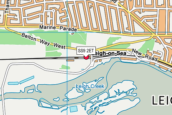
Leigh Marshes (Closed) - Leigh-on-sea
Leigh Marshes (Closed) is located in Leigh-on-sea (SS9).
| Address | Leigh-on-sea, SS9 2ET |
| Management Type | Local Authority (in house) |
| Management Group | Local Authority |
| Owner Type | Local Authority |
| Owner Group | Local Authority |
| Education Phase | Not Known |
| Closure Date | 1st Jan 1999 |
| Closure Reason | Unclassified |
Facilities
| Closure Date | 1st Jan 1999 |
| Closure Reason | Unclassified |
| Accessibility | Free Public Access |
| Management Type | Not Known |
| Changing Rooms | No |
| Date Record Checked | 10th Jul 2009 |
| Opening Times | Detailed Timings |
Facility specifics
Where is Leigh Marshes (Closed)?
| Sub Building Name | |
| Building Name | |
| Building Number | 0 |
| Dependent Thoroughfare | |
| Thoroughfare Name | |
| Double Dependent Locality | |
| Dependent Locality | |
| PostTown | Leigh-on-Sea |
| Postcode | SS9 2ET |
Leigh Marshes (Closed) on a map

Leigh Marshes (Closed) geodata
| Easting | 582605.65 |
| Northing | 185666.87 |
| Latitude | 51.540358 |
| Longitude | 0.631786 |
| Local Authority Name | Southend-on-Sea |
| Local Authority Code | E06000033 |
| Parliamentary Constituency Name | Southend West |
| Parliamentary Constituency Code | E14000957 |
| Region Name | Eastern |
| Region Code | E15000006 |
| Ward Name | West Leigh |
| Ward Code | E05002227 |
| Output Area Code | E00080445 |
About this data
This data is open data sourced from Active Places Power and licenced under the Active Places Open Data Licence.
| Created On | 18th May 2007 |
| Audited On | 26th Jan 2015 |
| Checked On | 10th Jul 2009 |
