Knowsley Recreation Ground - Knowsley Village
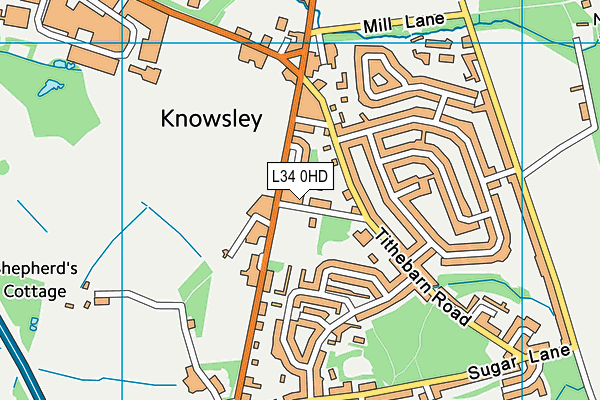
Knowsley Recreation Ground is located in Knowsley Village (L34).
| Address | RECREATION GROUND, Shop Road, Knowsley Village, L34 0HD |
| Car Park | Yes |
| Car Park Capacity | 4 |
| Management Type | Local Authority (in house) |
| Management Group | Local Authority |
| Owner Type | Local Authority |
| Owner Group | Local Authority |
| Education Phase | Not applicable |
Facilities
| Accessibility | Free Public Access |
| Management Type | Local Authority (in house) |
| Changing Rooms | Yes |
| Date Record Checked | 19th Oct 2022 |
| Opening Times | Dawn To Dusk |
Facility specifics
Disabled access
| Disabled Access | Yes |
| Finding/Reaching Entrance | Yes |
| Doorways | Yes |
| Activity Areas | Yes |
| Disabled Toilets | Yes |
| Emergency Exits | Yes |
| Notes | There is a parking layby directly opposite the site for additional parking. |
Contact
Disabled access
Disabled access for Knowsley Recreation Ground
| Disabled Access | Yes |
| Finding/Reaching Entrance | Yes |
| Doorways | Yes |
| Activity Areas | Yes |
| Disabled Toilets | Yes |
| Emergency Exits | Yes |
| Notes | There is a parking layby directly opposite the site for additional parking. |
Where is Knowsley Recreation Ground?
| Sub Building Name | |
| Building Name | RECREATION GROUND |
| Building Number | 0 |
| Dependent Thoroughfare | |
| Thoroughfare Name | SHOP ROAD |
| Double Dependent Locality | |
| Dependent Locality | |
| PostTown | KNOWSLEY VILLAGE |
| Postcode | L34 0HD |
Knowsley Recreation Ground on a map

Knowsley Recreation Ground geodata
| Easting | 343450 |
| Northing | 395550 |
| Latitude | 53.453656 |
| Longitude | -2.853046 |
| Local Authority Name | Knowsley |
| Local Authority Code | E08000011 |
| Parliamentary Constituency Name | Knowsley |
| Parliamentary Constituency Code | E14000775 |
| Region Name | North West |
| Region Code | E15000002 |
| Ward Name | Prescot North |
| Ward Code | E05010940 |
| Output Area Code | E00032633 |
About this data
This data is open data sourced from Active Places Power and licenced under the Active Places Open Data Licence.
| toid | osgb1000002072738764 |
| Created On | 23rd Oct 2009 |
| Audited On | 19th Oct 2022 |
| Checked On | 4th Jul 2023 |
