Knoll Park - Hove
Knoll Park is located in Hove (BN3), and offers Artificial Grass Pitch, and Grass Pitches.
| Address | 83, Stapley Road, Hove, BN3 7FF |
| Management Type | Local Authority (in house) |
| Management Group | Local Authority |
| Owner Type | Local Authority |
| Owner Group | Local Authority |
| Education Phase | Not applicable |
Facilities
| Accessibility | Free Public Access |
| Management Type | Local Authority (in house) |
| Year Built | 2000 |
| Year Refurbished | 2011 |
| Changing Rooms | No |
| Date Record Checked | 25th Oct 2022 |
Opening times
| Access description | Free Public Access |
|---|
| Opening time | 08:00 |
| Closing time | 22:00 |
| Period open for | Every day |
Facility specifics
| Area | 648m² |
| Floodlit | Yes |
| Indoor | No |
| Length | 36m |
| Width | 18m |
| WR22 Compliant Pitch | No |
Disabled access
| Disabled Access | Yes |
| Finding/Reaching Entrance | Yes |
| Activity Areas | Yes |
| Status Notes | Re-opened on Active Places 22/02/2018
Pitch is not marked out. |
| Accessibility | Free Public Access |
| Management Type | Local Authority (in house) |
| Changing Rooms | No |
| Date Record Checked | 25th Oct 2022 |
| Opening Times | Dawn To Dusk |
Facility specifics
Disabled access
| Disabled Access | Yes |
| Finding/Reaching Entrance | Yes |
| Activity Areas | Yes |
| Accessibility | Free Public Access |
| Management Type | Local Authority (in house) |
| Changing Rooms | Yes |
| Date Record Created | 18th Aug 2020 |
| Date Record Checked | 25th Oct 2022 |
| Opening Times | Dawn To Dusk |
Facility specifics
Disabled access
| Disabled Access | Yes |
| Finding/Reaching Entrance | Yes |
| Activity Areas | Yes |
Contact
Disabled access
Disabled access for Knoll Park
| Disabled Access | Yes |
| Finding/Reaching Entrance | Yes |
| Activity Areas | Yes |
Where is Knoll Park?
| Sub Building Name | |
| Building Name | |
| Building Number | 83 |
| Dependent Thoroughfare | |
| Thoroughfare Name | STAPLEY ROAD |
| Double Dependent Locality | |
| Dependent Locality | |
| PostTown | HOVE |
| Postcode | BN3 7FF |
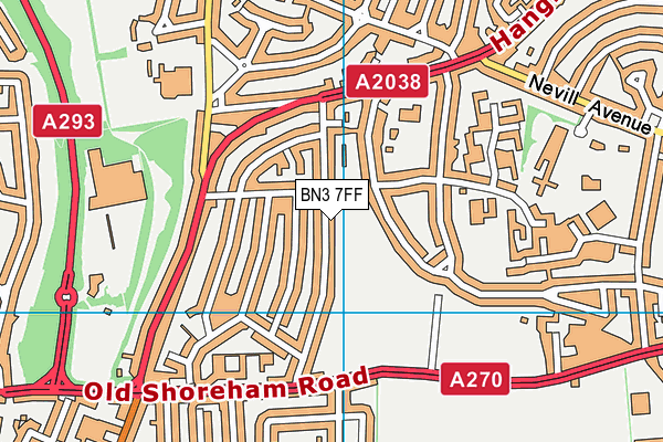
Knoll Park on a map

Knoll Park geodata
| Easting | 527014.84 |
| Northing | 106158.33 |
| Latitude | 50.841021 |
| Longitude | -0.197407 |
| Local Authority Name | Brighton and Hove |
| Local Authority Code | E06000043 |
| Parliamentary Constituency Name | Hove |
| Parliamentary Constituency Code | E14000755 |
| Region Name | South East |
| Region Code | E15000008 |
| Ward Name | Hangleton and Knoll |
| Ward Code | E05002424 |
| Output Area Code | E00085215 |
About this data
This data is open data sourced from Active Places Power and licenced under the Active Places Open Data Licence.
| Created On | 10th Feb 2014 |
| Audited On | 25th Oct 2022 |
| Checked On | 25th Oct 2022 |
