Kirby Muxloe Golf Club
Kirby Muxloe Golf Club is located in Kirby Muxloe, Leicester (LE9), and offers Golf.
| Address | Station Road, Kirby Muxloe, Leicester, LE9 2EP |
| Car Park | Yes |
| Car Park Capacity | 120 |
| Management Type | Commercial Management |
| Management Group | Commercial |
| Owner Type | Sports Club |
| Owner Group | Sports Club |
| Education Phase | Not applicable |
Facilities
| Accessibility | Pay and Play |
| Management Type | Commercial Management |
| Year Built | 1893 |
| Changing Rooms | Yes |
| Year Changing Rooms Refurbished | 2004 |
| Date Record Checked | 11th Jan 2023 |
| Opening Times | Dawn To Dusk |
Facility specifics
Disabled access
| Disabled Access | Yes |
| Disabled Parking | Yes |
| Finding/Reaching Entrance | Yes |
| Reception Area | Yes |
| Doorways | Yes |
| Disabled Changing Facilities | Yes |
| Activity Areas | Yes |
| Disabled Toilets | Yes |
| Social Areas | Yes |
| Spectator Areas | Yes |
| Emergency Exits | Yes |
| Status Notes | 5 bays |
| Accessibility | Pay and Play |
| Management Type | Commercial Management |
| Year Built | 1893 |
| Changing Rooms | Yes |
| Date Record Created | 19th Sep 2018 |
| Date Record Checked | 11th Jan 2023 |
| Opening Times | Dawn To Dusk |
Facility specifics
Disabled access
| Disabled Access | Yes |
| Disabled Parking | Yes |
| Finding/Reaching Entrance | Yes |
| Reception Area | Yes |
| Doorways | Yes |
| Disabled Changing Facilities | Yes |
| Activity Areas | Yes |
| Disabled Toilets | Yes |
| Social Areas | Yes |
| Spectator Areas | Yes |
| Emergency Exits | Yes |
Contact
Disabled access
Disabled access for Kirby Muxloe Golf Club
| Disabled Access | Yes |
| Disabled Parking | Yes |
| Finding/Reaching Entrance | Yes |
| Reception Area | Yes |
| Doorways | Yes |
| Disabled Changing Facilities | Yes |
| Activity Areas | Yes |
| Disabled Toilets | Yes |
| Social Areas | Yes |
| Spectator Areas | Yes |
| Emergency Exits | Yes |
Where is Kirby Muxloe Golf Club?
| Sub Building Name | |
| Building Name | |
| Building Number | 0 |
| Dependent Thoroughfare | |
| Thoroughfare Name | STATION ROAD |
| Double Dependent Locality | |
| Dependent Locality | KIRBY MUXLOE |
| PostTown | LEICESTER |
| Postcode | LE9 2EP |
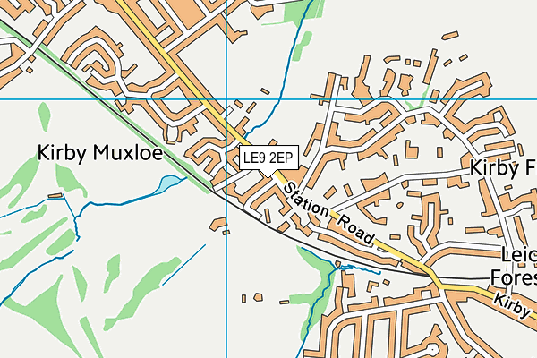
Kirby Muxloe Golf Club on a map

Kirby Muxloe Golf Club geodata
| Easting | 451979 |
| Northing | 303658 |
| Latitude | 52.628199 |
| Longitude | -1.233502 |
| Local Authority Name | Blaby |
| Local Authority Code | E07000129 |
| Parliamentary Constituency Name | Charnwood |
| Parliamentary Constituency Code | E14000625 |
| Region Name | East Midlands |
| Region Code | E15000004 |
| Ward Name | Muxloe |
| Ward Code | E05005417 |
| Output Area Code | E00130112 |
About this data
This data is open data sourced from Active Places Power and licenced under the Active Places Open Data Licence.
| toid | osgb1000022575227 |
| Created On | 26th Apr 2004 |
| Audited On | 11th Jan 2023 |
| Checked On | 11th Jan 2023 |
