Killiow Golf Club (Closed) - Playing Place
Killiow Golf Club (Closed) is located in Playing Place (TR3).
| Address | KILLIOW GOLF CLUB, A39 Between Arch Hill And Chyreen Lane, Playing Place, TR3 6AG |
| Car Park | Yes |
| Car Park Capacity | 120 |
| Management Type | Sport Club |
| Management Group | Others |
| Owner Type | Sports Club |
| Owner Group | Sports Club |
| Education Phase | Not Known |
| Closure Date | 29th Apr 2020 |
| Closure Reason | Strategic Review - facility/site not being replaced |
Facilities
| Closure Date | 29th Apr 2020 |
| Closure Reason | Strategic Review - facility/site not being replaced |
| Accessibility | Pay and Play |
| Management Type | Sport Club |
| Year Built | 1987 |
| Changing Rooms | Yes |
| Year Changing Rooms Refurbished | 2006 |
| Date Record Checked | 29th Apr 2020 |
| Opening Times | Dawn To Dusk |
Facility specifics
Disabled access
| Disabled Access | Yes |
| Finding/Reaching Entrance | Yes |
| Reception Area | Yes |
| Doorways | Yes |
| Social Areas | Yes |
| Spectator Areas | Yes |
| Emergency Exits | Yes |
| Closure Date | 29th Apr 2020 |
| Closure Reason | Strategic Review - facility/site not being replaced |
| Accessibility | Pay and Play |
| Management Type | Sport Club |
| Year Built | 1987 |
| Changing Rooms | Yes |
| Date Record Created | 27th May 2016 |
| Date Record Checked | 29th Apr 2020 |
| Opening Times | Dawn To Dusk |
Facility specifics
Disabled access
| Disabled Access | Yes |
| Finding/Reaching Entrance | Yes |
| Reception Area | Yes |
| Doorways | Yes |
| Social Areas | Yes |
| Spectator Areas | Yes |
| Emergency Exits | Yes |
Contact
Disabled access
Disabled access for Killiow Golf Club (Closed)
| Disabled Access | Yes |
| Finding/Reaching Entrance | Yes |
| Reception Area | Yes |
| Doorways | Yes |
| Social Areas | Yes |
| Spectator Areas | Yes |
| Emergency Exits | Yes |
Where is Killiow Golf Club (Closed)?
| Sub Building Name | |
| Building Name | KILLIOW GOLF CLUB |
| Building Number | 0 |
| Dependent Thoroughfare | |
| Thoroughfare Name | A39 BETWEEN ARCH HILL AND CHYREEN LANE |
| Double Dependent Locality | |
| Dependent Locality | |
| PostTown | PLAYING PLACE |
| Postcode | TR3 6AG |
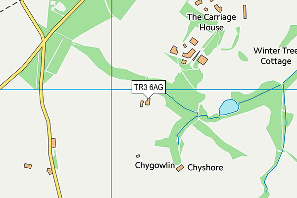
Killiow Golf Club (Closed) on a map

Killiow Golf Club (Closed) geodata
| Easting | 180673 |
| Northing | 42389 |
| Latitude | 50.240705 |
| Longitude | -5.07727 |
| Local Authority Name | Cornwall |
| Local Authority Code | E06000052 |
| Parliamentary Constituency Name | Truro and Falmouth |
| Parliamentary Constituency Code | E14001003 |
| Region Name | South West |
| Region Code | E15000009 |
| Ward Name | Feock and Playing Place |
| Ward Code | E05009182 |
| Output Area Code | E00094999 |
About this data
This data is open data sourced from Active Places Power and licenced under the Active Places Open Data Licence.
| toid | osgb1000002033422812 |
| Created On | 26th Apr 2004 |
| Audited On | 16th Apr 2019 |
| Checked On | 28th Apr 2020 |
