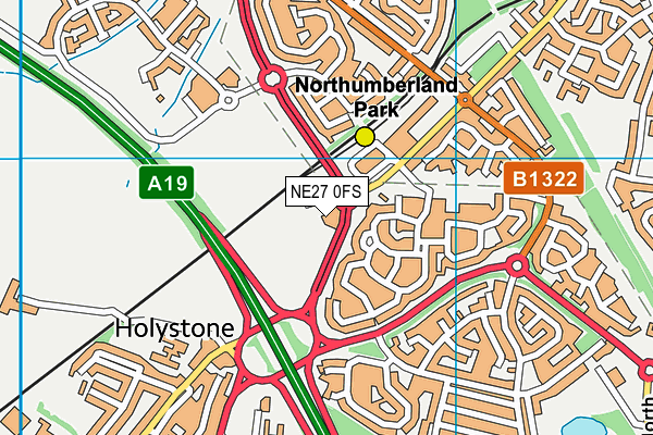
Jd Gyms (Newcastle Shiremoor) - Northumberland Park Way
Jd Gyms (Newcastle Shiremoor) is located in Northumberland Park Way, Backworth (NE27), and offers Health and Fitness Gym.
| Address | JD GYMS UNIT, Northumberland Park Way, Northumberland Park Way, Backworth, NE27 0FS |
| Car Park | Yes |
| Car Park Capacity | 100 |
| Management Type | Commercial Management |
| Management Group | Commercial |
| Owner Type | Commercial |
| Owner Group | Commercial |
| Education Phase | Not applicable |
Facilities
| Accessibility | Registered Membership use |
| Management Type | Commercial Management |
| Year Built | 2018 |
| Changing Rooms | Yes |
| Date Record Created | 17th Mar 2020 |
| Date Record Checked | 8th Sep 2023 |
Opening times
| Access description | Registered Membership use |
|---|
| Opening time | 06:00 |
| Closing time | 22:00 |
| Period open for | Monday-Friday |
| |
| Access description | Registered Membership use |
|---|
| Opening time | 08:00 |
| Closing time | 22:00 |
| Period open for | Weekend |
Facility specifics
Disabled access
| Disabled Access | Yes |
| Disabled Parking | Yes |
| Finding/Reaching Entrance | Yes |
| Reception Area | Yes |
| Doorways | Yes |
| Disabled Changing Facilities | Yes |
| Activity Areas | Yes |
| Disabled Toilets | Yes |
| Emergency Exits | Yes |
Contact
Disabled access
Disabled access for Jd Gyms (Newcastle Shiremoor)
| Disabled Access | Yes |
| Disabled Parking | Yes |
| Finding/Reaching Entrance | Yes |
| Reception Area | Yes |
| Doorways | Yes |
| Disabled Changing Facilities | Yes |
| Activity Areas | Yes |
| Disabled Toilets | Yes |
| Emergency Exits | Yes |
Where is Jd Gyms (Newcastle Shiremoor)?
| Sub Building Name | |
| Building Name | JD GYMS UNIT |
| Building Number | 0 |
| Dependent Thoroughfare | |
| Thoroughfare Name | NORTHUMBERLAND PARK WAY |
| Double Dependent Locality | NORTHUMBERLAND PARK WAY |
| Dependent Locality | |
| PostTown | BACKWORTH |
| Postcode | NE27 0FS |
Jd Gyms (Newcastle Shiremoor) on a map

Jd Gyms (Newcastle Shiremoor) geodata
| Easting | 430551.36 |
| Northing | 570788.96 |
| Latitude | 55.030694 |
| Longitude | -1.523582 |
| Local Authority Name | North Tyneside |
| Local Authority Code | E08000022 |
| Parliamentary Constituency Name | Tynemouth |
| Parliamentary Constituency Code | E14001006 |
| Region Name | North East |
| Region Code | E15000001 |
| Ward Name | Valley |
| Ward Code | E05001131 |
| Output Area Code | E00166127 |
About this data
This data is open data sourced from Active Places Power and licenced under the Active Places Open Data Licence.
| toid | osgb5000005236529526 |
| Created On | 17th Mar 2020 |
| Audited On | 8th Sep 2023 |
| Checked On | 8th Sep 2023 |
