Horne Park Golf Club - South Godstone
Horne Park Golf Club is located in South Godstone, Godstone (RH9), and offers Golf.
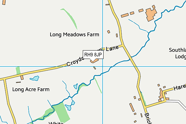
| Address | Croydon Barn Lane, South Godstone, Godstone, RH9 8JP |
| Car Park | Yes |
| Car Park Capacity | 120 |
| Management Type | Sport Club |
| Management Group | Others |
| Owner Type | Commercial |
| Owner Group | Commercial |
| Education Phase | Not applicable |
| Start Date | 10th Mar 2003 |
Facilities
| Opening Date | 1st Mar 2003 |
| Accessibility | Sports Club / Community Association |
| Management Type | Sport Club |
| Year Built | 1995 |
| Changing Rooms | Yes |
| Date Record Checked | 17th Jan 2023 |
| Opening Times | Dawn To Dusk |
Facility specifics
Disabled access
| Disabled Access | Yes |
| Disabled Parking | Yes |
| Finding/Reaching Entrance | Yes |
| Reception Area | Yes |
| Doorways | Yes |
| Disabled Changing Facilities | Yes |
| Activity Areas | Yes |
| Disabled Toilets | Yes |
| Social Areas | Yes |
| Emergency Exits | Yes |
| Accessibility | Pay and Play |
| Management Type | Sport Club |
| Year Built | 1995 |
| Changing Rooms | Yes |
| Date Record Checked | 17th Jan 2023 |
| Opening Times | Dawn To Dusk |
Facility specifics
Disabled access
| Disabled Access | Yes |
| Disabled Parking | Yes |
| Finding/Reaching Entrance | Yes |
| Reception Area | Yes |
| Doorways | Yes |
| Disabled Changing Facilities | Yes |
| Activity Areas | Yes |
| Disabled Toilets | Yes |
| Social Areas | Yes |
| Emergency Exits | Yes |
Contact
Disabled access
Disabled access for Horne Park Golf Club
| Disabled Access | Yes |
| Disabled Parking | Yes |
| Finding/Reaching Entrance | Yes |
| Reception Area | Yes |
| Doorways | Yes |
| Disabled Changing Facilities | Yes |
| Activity Areas | Yes |
| Disabled Toilets | Yes |
| Social Areas | Yes |
| Emergency Exits | Yes |
Where is Horne Park Golf Club?
| Sub Building Name | |
| Building Name | |
| Building Number | 0 |
| Dependent Thoroughfare | |
| Thoroughfare Name | CROYDON BARN LANE |
| Double Dependent Locality | |
| Dependent Locality | SOUTH GODSTONE |
| PostTown | GODSTONE |
| Postcode | RH9 8JP |
Horne Park Golf Club on a map

Horne Park Golf Club geodata
| Easting | 534351 |
| Northing | 143902 |
| Latitude | 51.178575 |
| Longitude | -0.079312 |
| Local Authority Name | Tandridge |
| Local Authority Code | E07000215 |
| Parliamentary Constituency Name | East Surrey |
| Parliamentary Constituency Code | E14000681 |
| Region Name | South East |
| Region Code | E15000008 |
| Ward Name | Burstow, Horne and Outwood |
| Ward Code | E05007410 |
| Output Area Code | E00157140 |
About this data
This data is open data sourced from Active Places Power and licenced under the Active Places Open Data Licence.
| toid | osgb1000006111432 |
| Created On | 26th Apr 2004 |
| Audited On | 17th Jan 2023 |
| Checked On | 17th Jan 2023 |
