Holme Hale Playing Field
Holme Hale Playing Field is located in Holme Hale, Thetford (IP25).
| Address | School Road, Holme Hale, Thetford, IP25 7DP |
| Car Park | Yes |
| Car Park Capacity | 40 |
| Management Type | Other |
| Management Group | Others |
| Owner Type | Other |
| Owner Group | Others |
| Education Phase | Not applicable |
Facilities
| Accessibility | Free Public Access |
| Management Type | Other |
| Year Built | 1972 |
| Year Refurbished | 2005 |
| Changing Rooms | No |
| Date Record Checked | 18th Oct 2023 |
| Opening Times | Dawn To Dusk |
Facility specifics
Contact
Where is Holme Hale Playing Field?
| Sub Building Name | |
| Building Name | |
| Building Number | 0 |
| Dependent Thoroughfare | |
| Thoroughfare Name | School Road |
| Double Dependent Locality | |
| Dependent Locality | Holme Hale |
| PostTown | Thetford |
| Postcode | IP25 7DP |
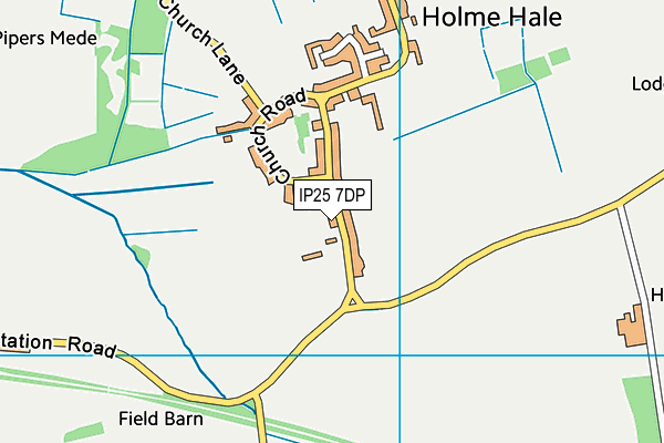
Holme Hale Playing Field on a map

Holme Hale Playing Field geodata
| Easting | 588823 |
| Northing | 307156 |
| Latitude | 52.629307 |
| Longitude | 0.788556 |
| Local Authority Name | Breckland |
| Local Authority Code | E07000143 |
| Parliamentary Constituency Name | Mid Norfolk |
| Parliamentary Constituency Code | E14000816 |
| Region Name | Eastern |
| Region Code | E15000006 |
| Ward Name | Necton |
| Ward Code | E05010253 |
| Output Area Code | E00134645 |
About this data
This data is open data sourced from Active Places Power and licenced under the Active Places Open Data Licence.
| Created On | 16th Nov 2006 |
| Audited On | 18th Oct 2023 |
| Checked On | 18th Oct 2023 |
