Holcombe Brook Sports Club - Hazel Hall Lane
Holcombe Brook Sports Club is located in Hazel Hall Lane, Ramsbottom, Bury (BL0), and offers Outdoor Tennis Courts.
| Address | Hazel Hall Lane, Hazel Hall Lane, Ramsbottom, Bury, BL0 9FS |
| Car Park | Yes |
| Car Park Capacity | 50 |
| Management Type | Sport Club |
| Management Group | Others |
| Owner Type | Sports Club |
| Owner Group | Sports Club |
| Education Phase | Not applicable |
Facilities
| Accessibility | Registered Membership use |
| Management Type | Sport Club |
| Year Built | 2014 |
| Changing Rooms | Yes |
| Date Record Created | 7th Apr 2020 |
| Date Record Checked | 18th Sep 2023 |
Opening times
| Access description | Registered Membership use |
|---|
| Opening time | 09:00 |
| Closing time | 21:30 |
| Period open for | Every day |
Facility specifics
| Floodlit | Yes |
| Overmarked | No |
| Surface Type | Macadam |
Disabled access
| Disabled Access | Yes |
| Finding/Reaching Entrance | Yes |
| Reception Area | Yes |
| Doorways | Yes |
| Disabled Changing Facilities | Yes |
| Activity Areas | Yes |
| Disabled Toilets | Yes |
| Emergency Exits | Yes |
| Accessibility | Registered Membership use |
| Management Type | Sport Club |
| Year Built | 2014 |
| Changing Rooms | Yes |
| Date Record Created | 13th Jul 2022 |
| Date Record Checked | 18th Sep 2023 |
| Opening Times | Dawn To Dusk |
Facility specifics
| Floodlit | No |
| Overmarked | No |
| Surface Type | Macadam |
Disabled access
| Disabled Access | Yes |
| Finding/Reaching Entrance | Yes |
| Reception Area | Yes |
| Doorways | Yes |
| Disabled Changing Facilities | Yes |
| Activity Areas | Yes |
| Disabled Toilets | Yes |
| Emergency Exits | Yes |
Contact
Disabled access
Disabled access for Holcombe Brook Sports Club
| Disabled Access | Yes |
| Finding/Reaching Entrance | Yes |
| Reception Area | Yes |
| Doorways | Yes |
| Disabled Changing Facilities | Yes |
| Activity Areas | Yes |
| Disabled Toilets | Yes |
| Emergency Exits | Yes |
Where is Holcombe Brook Sports Club?
| Sub Building Name | |
| Building Name | |
| Building Number | 0 |
| Dependent Thoroughfare | |
| Thoroughfare Name | HAZEL HALL LANE |
| Double Dependent Locality | HAZEL HALL LANE |
| Dependent Locality | RAMSBOTTOM |
| PostTown | BURY |
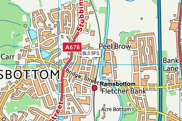
| Postcode | BL0 9FS |
Holcombe Brook Sports Club on a map

Holcombe Brook Sports Club geodata
| Easting | 378560.67 |
| Northing | 414115.3 |
| Latitude | 53.623131 |
| Longitude | -2.325615 |
| Local Authority Name | Bury |
| Local Authority Code | E08000002 |
| Parliamentary Constituency Name | Bury North |
| Parliamentary Constituency Code | E14000611 |
| Region Name | North West |
| Region Code | E15000002 |
| Ward Name | North Manor |
| Ward Code | E05014158 |
| Output Area Code | E00025422 |
About this data
This data is open data sourced from Active Places Power and licenced under the Active Places Open Data Licence.
| toid | osgb5000005170004452 |
| Created On | 7th Apr 2020 |
| Audited On | 18th Sep 2023 |
| Checked On | 18th Sep 2023 |
