Hertfordshire Fire And Rescue
Hertfordshire Fire And Rescue is located in Hertford (SG13), and offers Health and Fitness Gym.
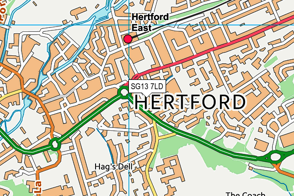
| Address | FIRE STATION, Old London Road, Hertford, SG13 7LD |
| Car Park | Yes |
| Car Park Capacity | 50 |
| Management Type | Other |
| Management Group | Others |
| Owner Type | Local Authority |
| Owner Group | Local Authority |
| Education Phase | Not applicable |
Facilities
| Status Notes | Squash Courts closed and Health and Fitness suite now located here. |
| Accessibility | Private Use |
| Management Type | Other |
| Year Built | 1985 |
| Year Refurbished | 2018 |
| Changing Rooms | Yes |
| Date Record Checked | 20th Jul 2023 |
Opening times
| Access description | Private Use |
|---|
| Opening time | 00:00 |
| Closing time | 23:59 |
| Period open for | Every day |
Facility specifics
Disabled access
| Disabled Access | Yes |
| Disabled Parking | Yes |
| Finding/Reaching Entrance | Yes |
| Doorways | Yes |
| Disabled Changing Facilities | Yes |
| Activity Areas | Yes |
| Disabled Toilets | Yes |
| Social Areas | Yes |
| Emergency Exits | Yes |
| Closure Date | 30th Jun 2018 |
| Closure Reason | Strategic Review - facility/site not being replaced |
| Accessibility | Private Use |
| Management Type | Other |
| Year Built | 1985 |
| Year Refurbished | 2017 |
| Changing Rooms | Yes |
| Date Record Checked | 20th Jul 2023 |
Opening times
| Access description | Private Use |
|---|
| Opening time | 00:00 |
| Closing time | 23:59 |
| Period open for | Every day |
Facility specifics
Disabled access
| Disabled Access | Yes |
| Disabled Parking | Yes |
| Finding/Reaching Entrance | Yes |
| Doorways | Yes |
| Disabled Changing Facilities | Yes |
| Social Areas | Yes |
| Emergency Exits | Yes |
Contact
Disabled access
Disabled access for Hertfordshire Fire And Rescue
| Disabled Access | Yes |
| Disabled Parking | Yes |
| Finding/Reaching Entrance | Yes |
| Doorways | Yes |
| Disabled Changing Facilities | Yes |
| Activity Areas | Yes |
| Disabled Toilets | Yes |
| Social Areas | Yes |
| Emergency Exits | Yes |
Where is Hertfordshire Fire And Rescue?
| Sub Building Name | |
| Building Name | FIRE STATION |
| Building Number | 0 |
| Dependent Thoroughfare | |
| Thoroughfare Name | OLD LONDON ROAD |
| Double Dependent Locality | |
| Dependent Locality | |
| PostTown | HERTFORD |
| Postcode | SG13 7LD |
Hertfordshire Fire And Rescue on a map

Hertfordshire Fire And Rescue geodata
| Easting | 533095.2 |
| Northing | 212624.2 |
| Latitude | 51.796438 |
| Longitude | -0.071381 |
| Local Authority Name | East Hertfordshire |
| Local Authority Code | E07000242 |
| Parliamentary Constituency Name | Hertford and Stortford |
| Parliamentary Constituency Code | E14000744 |
| Region Name | Eastern |
| Region Code | E15000006 |
| Ward Name | Hertford Castle |
| Ward Code | E05004726 |
| Output Area Code | E00119256 |
About this data
This data is open data sourced from Active Places Power and licenced under the Active Places Open Data Licence.
| toid | osgb1000009770244 |
| Created On | 11th May 2007 |
| Audited On | 20th Jul 2023 |
| Checked On | 20th Jul 2023 |
