Herne Hill Velodrome - London
Herne Hill Velodrome is located in London (SE24), and offers Cycling.
| Address | 104, Burbage Road, London, SE24 9HE |
| Car Park | Yes |
| Car Park Capacity | 20 |
| Management Type | Trust |
| Management Group | Trust |
| Owner Type | Community Organisation |
| Owner Group | Community Organisation |
| Education Phase | Not applicable |
| Start Date | 1st Jan 2020 |
Facilities
| Accessibility | Sports Club / Community Association |
| Management Type | Trust |
| Year Built | 1891 |
| Year Refurbished | 2011 |
| Changing Rooms | Yes |
| Year Changing Rooms Refurbished | 2017 |
| Date Record Created | 24th Feb 2017 |
| Date Record Checked | 30th Aug 2023 |
Opening times
| Access description | Sports Club / Community Association |
|---|
| Opening time | 09:00 |
| Closing time | 22:00 |
| Period open for | Every day |
Facility specifics
| Degree Of Banking At Middle Of Bends | 26° |
| Degree Of Banking At Middle Of Straights | 7° |
| Floodlit | Yes |
| Length Of Straights | 50m |
| Overall Width | 7m |
| Surface | Macadam |
| Timing System | Yes |
| Total Length | 450m |
Disabled access
| Disabled Access | Yes |
| Disabled Parking | Yes |
| Finding/Reaching Entrance | Yes |
| Reception Area | Yes |
| Doorways | Yes |
| Disabled Changing Facilities | Yes |
| Activity Areas | Yes |
| Disabled Toilets | Yes |
| Social Areas | Yes |
| Spectator Areas | Yes |
| Emergency Exits | Yes |
Contact
Disabled access
Disabled access for Herne Hill Velodrome
| Disabled Access | Yes |
| Disabled Parking | Yes |
| Finding/Reaching Entrance | Yes |
| Reception Area | Yes |
| Doorways | Yes |
| Disabled Changing Facilities | Yes |
| Activity Areas | Yes |
| Disabled Toilets | Yes |
| Social Areas | Yes |
| Spectator Areas | Yes |
| Emergency Exits | Yes |
Where is Herne Hill Velodrome?
| Sub Building Name | |
| Building Name | |
| Building Number | 104 |
| Dependent Thoroughfare | |
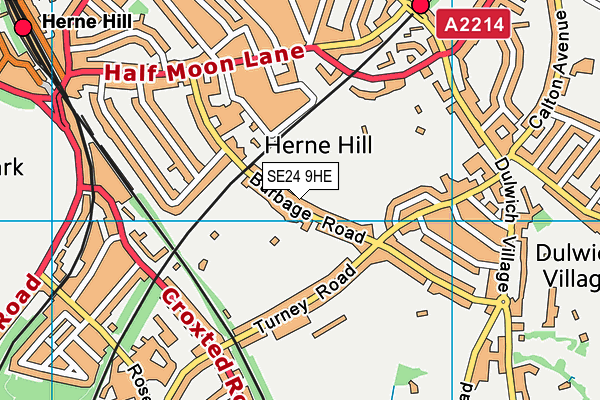
| Thoroughfare Name | BURBAGE ROAD |
| Double Dependent Locality | |
| Dependent Locality | |
| PostTown | LONDON |
| Postcode | SE24 9HE |
Herne Hill Velodrome on a map

Herne Hill Velodrome geodata
| Easting | 532781 |
| Northing | 174202 |
| Latitude | 51.451241 |
| Longitude | -0.090486 |
| Local Authority Name | Southwark |
| Local Authority Code | E09000028 |
| Parliamentary Constituency Name | Dulwich and West Norwood |
| Parliamentary Constituency Code | E14000673 |
| Region Name | London |
| Region Code | E15000007 |
| Ward Name | Dulwich Village |
| Ward Code | E05011100 |
| Output Area Code | E00020520 |
About this data
This data is open data sourced from Active Places Power and licenced under the Active Places Open Data Licence.
| toid | osgb1000005872171 |
| Created On | 24th Feb 2017 |
| Audited On | 30th Aug 2023 |
| Checked On | 30th Aug 2023 |
