Hale Lane Recreation Ground - Otford
Hale Lane Recreation Ground is located in Otford (TN14), and offers Grass Pitches.
| Address | HALE LANE RECREATION GROUND, Otford, TN14 5NP |
| Car Park | Yes |
| Car Park Capacity | 15 |
| Management Type | Local Authority (in house) |
| Management Group | Local Authority |
| Owner Type | Local Authority |
| Owner Group | Local Authority |
| Education Phase | Not applicable |
Facilities
| Status Notes | 9v9 pitch if needed will be marked out inside the 11v11 pitch.
|
| Accessibility | Sports Club / Community Association |
| Management Type | Local Authority (in house) |
| Changing Rooms | Yes |
| Date Record Created | 6th Apr 2016 |
| Date Record Checked | 7th Sep 2023 |
| Opening Times | Dawn To Dusk |
Facility specifics
Disabled access
| Disabled Access | Yes |
| Activity Areas | Yes |
| Notes | The site is disability-friendly from a parking point of view, however there are no disabled toilets, and exits do not have ramps at this time. |
| Accessibility | Sports Club / Community Association |
| Management Type | Local Authority (in house) |
| Changing Rooms | Yes |
| Date Record Created | 4th Apr 2018 |
| Date Record Checked | 7th Sep 2023 |
| Opening Times | Dawn To Dusk |
Facility specifics
Disabled access
| Disabled Access | Yes |
| Activity Areas | Yes |
| Notes | The site is disability-friendly from a parking point of view, however there are no disabled toilets, and exits do not have ramps at this time. |
Contact
Disabled access
Disabled access for Hale Lane Recreation Ground
| Disabled Access | Yes |
| Activity Areas | Yes |
| Notes | The site is disability-friendly from a parking point of view, however there are no disabled toilets, and exits do not have ramps at this time. |
Where is Hale Lane Recreation Ground?
| Sub Building Name | |
| Building Name | HALE LANE RECREATION GROUND |
| Building Number | 0 |
| Dependent Thoroughfare | |
| Thoroughfare Name | |
| Double Dependent Locality | |
| Dependent Locality | |
| PostTown | OTFORD |
| Postcode | TN14 5NP |
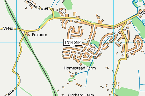
Hale Lane Recreation Ground on a map

Hale Lane Recreation Ground geodata
| Easting | 551419 |
| Northing | 158917 |
| Latitude | 51.30923 |
| Longitude | 0.171036 |
| Local Authority Name | Sevenoaks |
| Local Authority Code | E07000111 |
| Parliamentary Constituency Name | Sevenoaks |
| Parliamentary Constituency Code | E14000918 |
| Region Name | South East |
| Region Code | E15000008 |
| Ward Name | Otford and Shoreham |
| Ward Code | E05009962 |
| Output Area Code | E00124124 |
About this data
This data is open data sourced from Active Places Power and licenced under the Active Places Open Data Licence.
| Created On | 6th Apr 2016 |
| Audited On | 7th Sep 2023 |
| Checked On | 7th Sep 2023 |
