Hadfield Playing Field
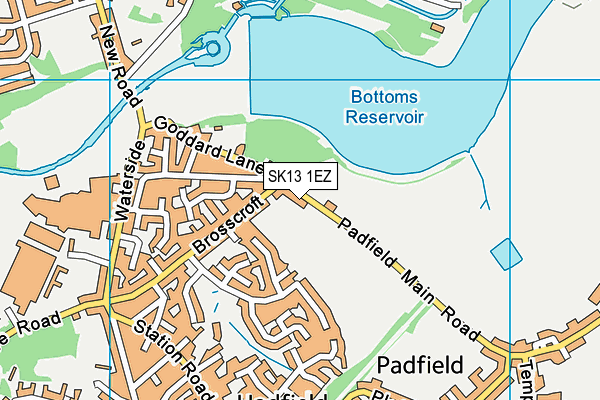
Hadfield Playing Field is located in Hadfield, Glossop (SK13).
| Address | Padfield Main Road, Hadfield, Glossop, SK13 1EZ |
| Management Type | Local Authority (in house) |
| Management Group | Local Authority |
| Owner Type | Local Authority |
| Owner Group | Local Authority |
| Education Phase | Not applicable |
Facilities
| Status Notes | Not level. |
| Accessibility | Free Public Access |
| Management Type | Local Authority (in house) |
| Changing Rooms | No |
| Date Record Checked | 22nd Nov 2022 |
| Opening Times | Dawn To Dusk |
Facility specifics
Contact
Where is Hadfield Playing Field?
| Sub Building Name | |
| Building Name | |
| Building Number | 0 |
| Dependent Thoroughfare | |
| Thoroughfare Name | PADFIELD MAIN ROAD |
| Double Dependent Locality | |
| Dependent Locality | HADFIELD |
| PostTown | GLOSSOP |
| Postcode | SK13 1EZ |
Hadfield Playing Field on a map

Hadfield Playing Field geodata
| Easting | 402688.75 |
| Northing | 396533.35 |
| Latitude | 53.465536 |
| Longitude | -1.960967 |
| Local Authority Name | High Peak |
| Local Authority Code | E07000037 |
| Parliamentary Constituency Name | High Peak |
| Parliamentary Constituency Code | E14000748 |
| Region Name | East Midlands |
| Region Code | E15000004 |
| Ward Name | Padfield |
| Ward Code | E05010642 |
| Output Area Code | E00099938 |
About this data
This data is open data sourced from Active Places Power and licenced under the Active Places Open Data Licence.
| toid | osgb5000005274093989 |
| Created On | 28th Sep 2005 |
| Audited On | 22nd Nov 2022 |
| Checked On | 6th Apr 2023 |
